Meggenhofen
Meggenhofen is a municipality in the district of Grieskirchen in the Austrian state of Upper Austria.
Meggenhofen | |
|---|---|
 | |
 Coat of arms | |
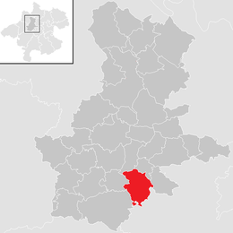 Location in the district | |
 Meggenhofen Location within Austria | |
| Coordinates: 48°10′53″N 13°47′47″E | |
| Country | Austria |
| State | Upper Austria |
| District | Grieskirchen |
| Government | |
| • Mayor | Heinz Oberndorfer (ÖVP) |
| Area | |
| • Total | 18.21 km2 (7.03 sq mi) |
| Elevation | 390 m (1,280 ft) |
| Population (2018-01-01)[2] | |
| • Total | 1,514 |
| • Density | 83/km2 (220/sq mi) |
| Time zone | UTC+1 (CET) |
| • Summer (DST) | UTC+2 (CEST) |
| Postal code | 4714 |
| Area code | 07247 |
| Vehicle registration | GR |
| Website | www.meggenhofen.at |
Geography
Meggenhofen lies in the Hausruckviertel. About 14 percent of the municipality is forest, and 76 percent is farmland.
gollark: Yep, I think.
gollark: A little.
gollark: That could be cool. mDNS or something to detect other computers could work, or it could just blindly broadcast and receive multicast packets.
gollark: Though it might be also a good idea to go the other way and use... buildroot or something?
gollark: Like I said, though, it may be a good idea to build off an existing Linux distribution (a lightweight one like Alpine), so you can get nice things like a package manager.
References
- "Dauersiedlungsraum der Gemeinden Politischen Bezirke und Bundesländer - Gebietsstand 1.1.2018". Statistics Austria. Retrieved 10 March 2019.
- "Einwohnerzahl 1.1.2018 nach Gemeinden mit Status, Gebietsstand 1.1.2018". Statistics Austria. Retrieved 9 March 2019.
| Wikimedia Commons has media related to Meggenhofen. |
This article is issued from Wikipedia. The text is licensed under Creative Commons - Attribution - Sharealike. Additional terms may apply for the media files.