Lyracappul
Lyracappul (Irish: Ladhar an Chapaill, meaning "fork/confluence of the horse") is a mountain in Limerick in Ireland. At a height of 825 metres (2,707 ft) it is the second highest of the Galtee Mountains and the 29th highest peak in Ireland.[1] Lyracappul is the second highest point in County Limerick.[1]
| Lyracappul | |
|---|---|
| Ladhar an Chapaill | |
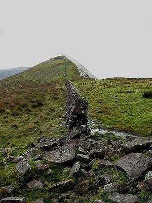 The wall on the summit | |
| Highest point | |
| Elevation | 825 m (2,707 ft) [1] |
| Prominence | 100 m (330 ft) [1] |
| Listing | Hewitt, Marilyn |
| Coordinates | 52.360427°N 8.227342°W |
| Naming | |
| English translation | fork/confluence of the horse |
| Language of name | Irish |
| Geography | |
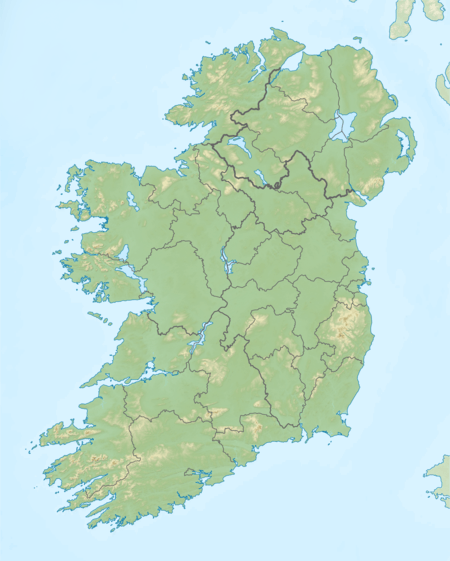 Lyracappul Location in Ireland | |
| Location | County Limerick, Ireland |
| Parent range | Galtee Mountains |
| OSI/OSNI grid | R878238 |
| Topo map | OSi Discovery 74 |
See also
References
- "Lyracappul". MountainViews. Retrieved 2 June 2019.
External links
| British Isles |  | |
|---|---|---|
| Scotland | ||
| Outside Scotland | ||
| England | ||
| Ireland | ||
| County tops | ||
Mountains and hills of Munster | |||||||
|---|---|---|---|---|---|---|---|
| Ballyhoura Mountains |  | ||||||
| Boggeragh Mountains | |||||||
| Caha Mountains | |||||||
| Comeragh Mountains | |||||||
| Derrynasaggart Mountains | |||||||
| Dingle Peninsula |
| ||||||
| Galty Mountains | |||||||
| Iveragh Peninsula | |||||||
| Knockmealdown Mountains | |||||||
| MacGillycuddy's Reeks |
| ||||||
| Mangerton Mountains | |||||||
| Shehy Mountains | |||||||
| Silvermine Mountains | |||||||
| Slieve Miskish Mountains | |||||||
| Others |
| ||||||
This article is issued from Wikipedia. The text is licensed under Creative Commons - Attribution - Sharealike. Additional terms may apply for the media files.