Bentee
Bentee or Benatee (from Irish: Binn an Tí, meaning "peak of the house")[1][2] is a hill overlooking the town of Cahersiveen in County Kerry, Ireland.
| Bentee | |
|---|---|
| Binn an Tí | |
 | |
| Highest point | |
| Elevation | 376 m (1,234 ft) |
| Prominence | 270 m (890 ft) |
| Listing | Marilyn |
| Coordinates | 51°56′N 10°13′W |
| Naming | |
| English translation | peak of the house |
| Geography | |
 Bentee | |
| OSI/OSNI grid | V476780 |
| Climbing | |
| Easiest route | Hike |
Geography
The hill has a height of 376 metres (1,234 ft), providing good views of the surrounding area, Valentia Island, the Skellig Islands, the Dingle Peninsula and MacGillycuddy's Reeks.
Access to the summit
In recent years the Bentee Loop walking trail has been created. The main paths are over farmland, with the permission of the owners.
gollark: Per cell?
gollark: Providing enough fuel sounds very !!FUN!!.
gollark: so they run much faster, you mean?
gollark: That's cool, actually. Imagine all the !!FUN!! fuel chains.
gollark: You can probably reach an efficiency of 2000% fairly easily.
References
- "Ordnance Survey Ireland - Online map viewer". Archived from the original on 2012-08-29. Retrieved 2010-07-17.
- Iveragh NW Area - Beentee MountainViews.ie
Mountains and hills of Munster | |||||||
|---|---|---|---|---|---|---|---|
| Ballyhoura Mountains | 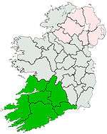 | ||||||
| Boggeragh Mountains | |||||||
| Caha Mountains | |||||||
| Comeragh Mountains | |||||||
| Derrynasaggart Mountains | |||||||
| Dingle Peninsula |
| ||||||
| Galty Mountains | |||||||
| Iveragh Peninsula | |||||||
| Knockmealdown Mountains | |||||||
| MacGillycuddy's Reeks |
| ||||||
| Mangerton Mountains | |||||||
| Shehy Mountains | |||||||
| Silvermine Mountains | |||||||
| Slieve Miskish Mountains | |||||||
| Others |
| ||||||
This article is issued from Wikipedia. The text is licensed under Creative Commons - Attribution - Sharealike. Additional terms may apply for the media files.