List of listed buildings in Paisley, Renfrewshire
List
| Name | Location | Date Listed | Grid Ref. [note 1] | Geo-coordinates | Notes | LB Number [note 2] | Image |
|---|---|---|---|---|---|---|---|
| Broomlands Street, Woodside Cemetery, Martyr's Monument (1 Of 2) | 55°50′37″N 4°26′33″W | Category B | 43485 |  | |||
| New Street, Paisley Arts Centre (Former Low Church) | 55°50′38″N 4°25′28″W | Category B | 39059 | 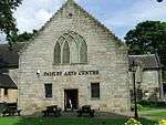 | |||
| 12 New Street | 55°50′40″N 4°25′35″W | Category B | 39061 | | |||
| 51-55 Oakshaw Street | 55°50′44″N 4°25′52″W | Category C(S) | 39073 | | |||
| 57 Oakshaw Street | 55°50′44″N 4°25′54″W | Category B | 39074 | | |||
| 6 Oakshaw Street Moran's Auction Rooms (Former Oakshaw East U.F. Church) | 55°50′46″N 4°25′36″W | Category B | 39075 | | |||
| 20 Oakshaw Street, Former Gaelic Church | 55°50′47″N 4°25′44″W | Category B | 39082 | | |||
| 62, 64 Oakshaw Street Former Cameronian Church | 55°50′44″N 4°25′59″W | Category C(S) | 39088 | | |||
| 66, 68 Oakshaw Street Former Manse | 55°50′44″N 4°25′59″W | Category C(S) | 39089 | | |||
| Orr Square Church Of Scotland | 55°50′44″N 4°25′47″W | Category B | 39093 | | |||
| 86, 88 Renfrew Road | 55°51′14″N 4°24′58″W | Category B | 39096 | | |||
| 94 Renfrew Road | 55°51′17″N 4°24′57″W | Category B | 39099 | | |||
| 6 St Mirren Street | 55°50′42″N 4°25′25″W | Category B | 39107 | | |||
| 14 Shuttle Street | 55°50′35″N 4°25′32″W | Category C(S) | 39113 | | |||
| Stanely Road, Moredun Lodge | 55°49′51″N 4°26′13″W | Category B | 39120 | | |||
| Glasgow Road, Paisley Grammar School Including Boundary Walls And Gatepiers Including Janitor's Lodge | 55°50′47″N 4°24′41″W | Category B | 39129 | 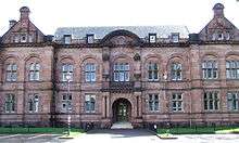 | |||
| 70-116 (Even Nos) And 55-101 (Odd Nos) Falside Road, Workmen's Cottages | 55°49′46″N 4°25′48″W | Category B | 39137 | | |||
| West End Cross, 2 Broomlands Street | 55°50′39″N 4°26′15″W | Category B | 39138 | | |||
| 11 Gauze Street Arnott's | 55°50′45″N 4°25′15″W | Category B | 38981 | | |||
| 10, 12 George Street | 55°50′34″N 4°25′31″W | Category B | 38990 | | |||
| 42 George Street, Paisley Technical College | 55°50′35″N 4°25′50″W | Category B | 38992 | | |||
| 7 Gilmour Street "Clydesdale Bank" | 55°50′46″N 4°25′26″W | Category A | 38994 | | |||
| 9 Gilmour Street | 55°50′46″N 4°25′26″W | Category B | 38995 | | |||
| 3-19 (Odd) Glasgow Road, Garthland Place | 55°50′50″N 4°24′54″W | Category B | 38998 | | |||
| Gordon Street, Former Fire Station | 55°50′32″N 4°25′22″W | Category B | 39006 | | |||
| Gordon Street / Johnston Street, St Matthew's Church Including Railings | 55°50′33″N 4°25′19″W | Category A | 39007 | 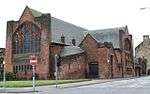 | |||
| Hawkhead Road, Hawkhead Hospital, Administration Block, Former Nurses Home, Wards 1-5, Boiler House And Mortuary, Laundry Block, Porter's Lodge, Waiting Room And Cottages | 55°50′02″N 4°23′32″W | Category B | 39010 | | |||
| 23 High Street, The Paisley Centre | 55°50′43″N 4°25′31″W | Category B | 39014 | 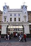 | |||
| 28 High Street | 55°50′43″N 4°25′35″W | Category B | 39022 | | |||
| 26 Hunterhill Road And Gate Piers | 55°50′13″N 4°24′55″W | Category B | 39028 | | |||
| 46, 48 Love Street | 55°51′02″N 4°25′34″W | Category C(S) | 39040 | | |||
| 53 Moss Street | 55°50′52″N 4°25′35″W | Category B | 39053 | | |||
| Neilston Road St Luke's Church | 55°50′15″N 4°25′30″W | Category C(S) | 39056 | | |||
| Abbey Close "Alexander Wilson" | 55°50′44″N 4°25′17″W | Category B | 38908 | | |||
| Abbey Close, Paisley Abbey | 55°50′42″N 4°25′13″W | Category A | 38910 | 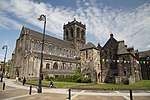 | |||
| Alice Street "Rosebank" | 55°50′03″N 4°25′42″W | Category B | 38913 | | |||
| Anchor Mills, Former Domestic Finishing Mill | 55°50′31″N 4°25′06″W | Category A | 38915 | 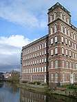 | |||
| Anchor Mills, Mile End Mill | 55°50′34″N 4°24′39″W | Category A | 38917 | 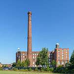 | |||
| 5 Caledonia Street | 55°50′56″N 4°25′50″W | Category B | 38931 | | |||
| Fountain At Angle Of Calside And Neilston Road | 55°50′19″N 4°25′31″W | Category C(S) | 38934 | | |||
| 43 Causeyside Street And 1 Johnston Street | 55°50′33″N 4°25′26″W | Category B | 38940 | | |||
| 20 Donaldswood Road, Blacklands Lodge And Gatepiers | 55°49′32″N 4°26′07″W | Category B | 38954 | | |||
| Dunn Square "Dunn Fountain" | 55°50′43″N 4°25′23″W | Category B | 38959 | | |||
| Ne Corner Of Falside Road And Braids Road, Brown And Polson Ltd | 55°49′46″N 4°25′36″W | Category B | 38963 | 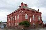 | |||
| Former Ferguslie Thread Works, Bridge Lane Gatehouse | 55°50′21″N 4°26′43″W | Category B | 38964 | 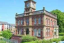 | |||
| Former Ferguslie Thread Works, Tannahill's Bridge | 55°50′20″N 4°26′34″W | Category C(S) | 38968 | | |||
| 5-11 (Odd) Forbes Place | 55°50′39″N 4°25′21″W | Category B | 38973 | | |||
| Nos 8, 10, 12 Forbes Place | 55°50′38″N 4°25′21″W | Category B | 38976 | | |||
| Gauze Street George A Clark Town Hall | 55°50′42″N 4°25′19″W | Category A | 38978 | 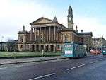 | |||
| Leitchland Farm | 55°49′32″N 4°28′53″W | Category C(S) | 18829 | | |||
| Auchenlodment House 136 Auchenlodment Road Elderslie | 55°49′36″N 4°29′40″W | Category C(S) | 18587 | | |||
| Incle Street, St Mirin's Roman Catholic Cathedral With Boundary Walls And Piers | 55°50′51″N 4°25′00″W | Category B | 46284 | 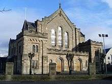 | |||
| Thornly Park, 17 South Avenue, Foxburn Including Boundary Walls And Gatepiers | 55°49′32″N 4°24′58″W | Category C(S) | 48039 | | |||
| Thornly Park, 19 South Avenue, Arthurlie | 55°49′32″N 4°24′56″W | Category C(S) | 48040 | | |||
| Thornly Park, 10 Thornly Park Avenue, Glenarm Including Boundary Walls, Gatepiers And Gates | 55°49′33″N 4°25′05″W | Category C(S) | 48049 | | |||
| 215 Glasgow Road, Barshaw House | 55°50′51″N 4°23′28″W | Category B | 44766 | 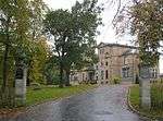 | |||
| 22 New Street | 55°50′38″N 4°25′32″W | Category C(S) | 39064 | | |||
| 10 Oakshaw Street | 55°50′47″N 4°25′38″W | Category C(S) | 39078 | | |||
| 12, 14 Oakshaw Street | 55°50′47″N 4°25′39″W | Category C(S) | 39079 | | |||
| Underwood Road, Railway Viaduct | 55°50′54″N 4°25′53″W | Category B | 39126 | | |||
| Park Road, Scotscraig | 55°49′53″N 4°26′05″W | Category B | 39131 | | |||
| 4, 6 Gilmour Street | 55°50′45″N 4°25′25″W | Category B | 38996 | 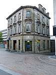 | |||
| 1 Glasgow Road | 55°50′50″N 4°24′58″W | Category C(S) | 38997 | | |||
| 83, Glasgow Road Arthur Allison Memorial Hall | 55°50′49″N 4°24′18″W | Category C(S) | 39000 | 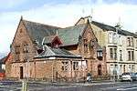 | |||
| 4 Glen Street | 55°50′58″N 4°25′36″W | Category C(S) | 39004 | | |||
| 6, High Road, Castlehead | 55°50′23″N 4°26′16″W | Category B | 39013 | | |||
| 39 High Street And 5 New Street, Ymca | 55°50′42″N 4°25′35″W | Category B | 39015 | | |||
| 10, 10A And 12 High Street And 2 Moss Street | 55°50′44″N 4°25′29″W | Category B | 39017 | | |||
| 18 High Street | 55°50′43″N 4°25′32″W | Category B | 39018 | | |||
| 30 High Street | 55°50′43″N 4°25′34″W | Category B | 39023 | | |||
| High Street, Coats Memorial Church | 55°50′41″N 4°25′57″W | Category A | 39027 | 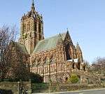 | |||
| Inchinnan Road, Landmark Warehouse | 55°51′18″N 4°25′37″W | Category B | 39029 | | |||
| Nos 17-25 (Odd) Lady Lane | 55°50′36″N 4°25′56″W | Category B | 39031 | 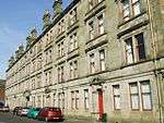 | |||
| Fountain Gardens Love Street Fountain | 55°51′01″N 4°25′44″W | Category A | 39035 | | |||
| 42, 44 Love Street | 55°51′01″N 4°25′34″W | Category C(S) | 39039 | | |||
| 69-83 (Odd) Maxwellton Road | 55°50′26″N 4°26′56″W | Category B | 39046 | | |||
| Moredun Road "Crosbie" | 55°49′42″N 4°26′50″W | Category A | 39049 | | |||
| 1-5 (Odd) Moss Street | 55°50′44″N 4°25′28″W | Category B | 39050 | | |||
| 6 Moss Street/1 The Cross | 55°50′45″N 4°25′27″W | Category B | 39054 | | |||
| Neilston Road Royal Alexandra Infirmary | 55°50′13″N 4°25′33″W | Category B | 39057 | 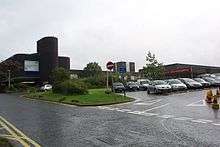 | |||
| 1-3 (Odd Nos) Causeyside Street And 21 Forbes Place | 55°50′41″N 4°25′22″W | Category B | 38937 | | |||
| Church Hill Former Middle Church Hall | 55°50′44″N 4°25′38″W | Category C(S) | 38949 | | |||
| 1-5 (Odd) County Place, 15 Gilmour Street And 20 Moss Street | 55°50′47″N 4°25′27″W | Category B | 38951 | | |||
| Elderslie Kirk (West), 284 Main Road, Elderslie | 55°50′09″N 4°29′29″W | Category C(S) | 19893 | | |||
| Ralston Golf Clubhouse, Strathmore Ave., Ralston, Paisley | 55°50′40″N 4°22′59″W | Category C(S) | 18585 | | |||
| Caplethill Road, Thorscrag Including Ancillary Structure | 55°49′12″N 4°25′15″W | Category B | 48036 | | |||
| Thornly Park, 43 Thornly Park Avenue, Airdoch Including Boundary Walls, Gatepiers And Gates | 55°49′39″N 4°24′37″W | Category C(S) | 48047 | | |||
| 19 Park Road, Makerston House, Including Outbuilding, Gatepiers And Walls To Street | 55°49′51″N 4°25′56″W | Category C(S) | 49156 | | |||
| 15 And 17 Marshall's Lane And Cart Walk, Kelvin House | 55°50′38″N 4°25′19″W | Category C(S) | 50176 | | |||
| 21 Stonefield Avenue, Littlecroft | 55°49′42″N 4°25′03″W | Category B | 43891 | | |||
| 91, 93 New Sneddon Street "Adelphi House" | 55°51′08″N 4°25′29″W | Category B | 39066 | | |||
| 19 Oakshaw Street, Paisley High Church Halls | 55°50′47″N 4°25′44″W | Category B | 39070 |  | |||
| 35 Oakshaw Street | 55°50′46″N 4°25′48″W | Category B | 39071 | | |||
| 49 Oakshaw Street Coats Observatory | 55°50′44″N 4°25′52″W | Category A | 39072 | | |||
| 6A Oakshaw Street (Former Church Hall) | 55°50′46″N 4°25′36″W | Category B | 39076 | | |||
| 60 Oakshaw Street | 55°50′45″N 4°25′57″W | Category B | 39087 | | |||
| Queen Street Tannahill's Cottage | 55°50′35″N 4°26′18″W | Category B | 39094 |  | |||
| 92 Renfrew Road | 55°51′16″N 4°24′58″W | Category B | 39098 | | |||
| St James Street Procurator Fiscal's Office | 55°50′55″N 4°25′37″W | Category B | 39104 | | |||
| Stanely Road "Sanctuary House" | 55°49′56″N 4°26′08″W | Category B | 39121 | | |||
| Abbeymill, Former Anchor Mills, Seedhill Footbridge And Gate | 55°50′28″N 4°25′05″W | Category B | 39135 | | |||
| 11-17 (Odd Nos) George Place | 55°50′35″N 4°25′34″W | Category C(S) | 38987 | | |||
| 6, 8 George Street | 55°50′33″N 4°25′30″W | Category B | 38989 | | |||
| 3 Gilmour Street "Bank Of Scotland" | 55°50′45″N 4°25′26″W | Category B | 38993 | | |||
| 8 Glasgow Road | 55°50′49″N 4°24′56″W | Category C(S) | 39002 | | |||
| High Street, Museum, Art Gallery And Library | 55°50′43″N 4°25′49″W | Category A | 39025 | 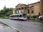 | |||
| 52 Love Street | 55°51′02″N 4°25′33″W | Category B | 39041 | | |||
| Broomlands Martyrs Church | 55°50′39″N 4°26′19″W | Category B | 38927 | | |||
| 18-22 (Evens) Causeyside | 55°50′39″N 4°25′25″W | Category B | 38945 | | |||
| Church Hill, Former Grammar School | 55°50′45″N 4°25′39″W | Category B | 38947 | | |||
| Church Hill Christian Social Action Centre | 55°50′45″N 4°25′38″W | Category A | 38948 | .jpg) | |||
| The Cross, War Memorial | 55°50′44″N 4°25′27″W | Category A | 38953 | 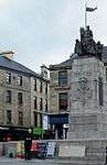 | |||
| Dunn Square, Queen Victoria Monument | 55°50′42″N 4°25′23″W | Category B | 38956 | | |||
| Dunn Square, "Sir Peter Coats" | 55°50′43″N 4°25′24″W | Category B | 38958 | | |||
| 38 Ferguslie Former Stables And Gatepiers To Ferguslie Gardens | 55°50′28″N 4°27′03″W | Category B | 38972 | | |||
| "West Lodge", (Of Former Ralston House,) 226 Glasgow Road, Ralston | 55°50′45″N 4°23′11″W | Category B | 18584 | | |||
| The Wallace Monument, At No. 243 Main Road, Elderslie | 55°50′08″N 4°29′20″W | Category B | 18586 |  | |||
| East Buchanan Street, Cathedral House And St Mirin's Old Academy | 55°50′52″N 4°25′03″W | Category C(S) | 46283 | 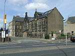 | |||
| 50 High Street And 1 Orr Square | 55°50′43″N 4°25′43″W | Category C(S) | 50175 | | |||
| Penilee Road, Paisley Grammar School, Penilee Sports Pavilion | 55°50′56″N 4°22′44″W | Category A | 43679 | | |||
| North Croft Street, Wallneuk Church | 55°50′55″N 4°25′15″W | Category B | 39068 | | |||
| 16 Oakshaw Street | 55°50′47″N 4°25′41″W | Category C(S) | 39080 | | |||
| 6 Orr Square | 55°50′43″N 4°25′43″W | Category B | 39091 | | |||
| 90 Renfrew Road | 55°51′15″N 4°24′58″W | Category B | 39097 | | |||
| St James Street Sheriff Court House | 55°50′55″N 4°25′37″W | Category A | 39103 | 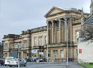 | |||
| 10 St Mirren Street | 55°50′41″N 4°25′25″W | Category C(S) | 39109 | | |||
| School Wynd St John's Church (C Of S) | 55°50′46″N 4°25′32″W | Category B | 39112 | 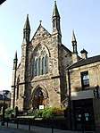 | |||
| 6, 8 Smithhills Street | 55°50′47″N 4°25′17″W | Category B | 39114 | | |||
| Stevenson Street, "Spiersfield" (Excluding Modern Extensions) | 55°50′20″N 4°25′45″W | Category B | 39115 | | |||
| Stanely Reservoir Stanely Castle | 55°49′24″N 4°27′14″W | Category B | 39116 | | |||
| Station Road Former Stable Block, And Gatepiers Ferguslie Mills | 55°50′28″N 4°27′03″W | Category C(S) | 39123 | | |||
| Glasgow Road Sherwood Church | 55°50′50″N 4°24′36″W | Category B | 38999 | | |||
| Hawkhead House Farm Steading Excluding Later Additions | 55°49′49″N 4°23′08″W | Category B | 39009 | | |||
| Hawkhead Road, Hawkhead Hospital, Wards 7 And 8 | 55°50′04″N 4°23′29″W | Category A | 39011 | | |||
| Hawkhead Road, Ross House | 55°50′00″N 4°23′38″W | Category B | 39012 | | |||
| 20 High Street Masonic Hall | 55°50′44″N 4°25′32″W | Category B | 39019 | | |||
| 24 High Street | 55°50′43″N 4°25′34″W | Category B | 39020 | | |||
| 76 High Street Territorial Army Centre | 55°50′41″N 4°25′54″W | Category B | 39026 | | |||
| Lonend, Watermill Hotel | 55°50′33″N 4°25′10″W | Category C(S) | 39032 | | |||
| Fountain Gardens, Love Street: Burns Statue | 55°51′02″N 4°25′43″W | Category B | 39036 | 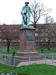 | |||
| Abbey Bridge | 55°50′38″N 4°25′15″W | Category B | 38907 | | |||
| Abbey Close "Robert Tannahill" | 55°50′43″N 4°25′16″W | Category B | 38909 | | |||
| Off Barrhead Road Blackhall Manor House | 55°50′16″N 4°24′41″W | Category B | 38922 | | |||
| Blackstoun Road Former Glencoats Hospital East Lodge Including Gatepiers And Railings | 55°50′50″N 4°26′53″W | Category B | 38925 | | |||
| Park Road, St Margaret's (Former Hospital) | 55°50′02″N 4°25′53″W | Category B | 38933 | | |||
| 45-47 (Odd Nos) Causeyside Street And Johnston Street | 55°50′32″N 4°25′26″W | Category B | 38941 | | |||
| Causeyside Street Russell Institute | 55°50′37″N 4°25′26″W | Category A | 38944 | 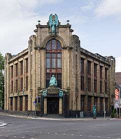 | |||
| Dunn Square, "Thomas Coats" | 55°50′43″N 4°25′23″W | Category B | 38957 | | |||
| 13-15 (Odd) Forbes Place | 55°50′39″N 4°25′20″W | Category B | 38974 | | |||
| Thornly Park, 9 South Avenue, Holmhurst Including Terrace Wall | 55°49′31″N 4°25′04″W | Category B | 48037 | | |||
| Thornly Park, 29 Thornly Park Avenue, Lismore Including Arch And Gatepeirs | 55°49′37″N 4°24′50″W | Category C(S) | 48044 | | |||
| Thornly Park, 33 Thornly Park Avenue Including Boundary Walls, Gatepiers And Gates | 55°49′38″N 4°24′47″W | Category C(S) | 48046 | | |||
| 6 And 8 High Street, Burton's | 55°50′44″N 4°25′24″W | Category B | 50162 | 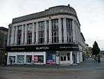 | |||
| Blackhall Lane, Blackhall House | 55°50′26″N 4°24′56″W | Category C(S) | 50498 | | |||
| Renfrew Road, Abercorn School, Including Entrance Steps And Railings | 55°51′14″N 4°25′07″W | Category C(S) | 45579 | 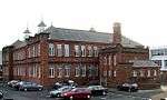 | |||
| 4 Sandholes Street | 55°50′40″N 4°26′15″W | Category C(S) | 43486 | | |||
| 7 New Street The Bull Inn | 55°50′41″N 4°25′34″W | Category A | 39058 | | |||
| 38, 40 Oakshaw Street | 55°50′46″N 4°25′51″W | Category C(S) | 39083 | | |||
| 7, 9 Orr Square | 55°50′45″N 4°25′44″W | Category B | 39092 | | |||
| 15 School Wynd | 55°50′44″N 4°25′34″W | Category B | 39111 | | |||
| Storie Street Paisley College Of Technology, Hugh Smiley Annexe Formerly Hugh Smiley Day Nursery | 55°50′39″N 4°25′42″W | Category B | 39124 | | |||
| Underwood Road St James Church | 55°50′55″N 4°26′01″W | Category B | 39125 | | |||
| Walker Street Former Baptist Church | 55°50′37″N 4°26′08″W | Category C(S) | 39127 | | |||
| Greenhill Road, Four Square Tobacco Factory | 55°51′15″N 4°26′34″W | Category B | 39130 | | |||
| Cyril Street, Violet Street, Ralston Uf Church | 55°50′40″N 4°24′32″W | Category B | 39139 | | |||
| 3-9 (Odd) Gauze Street Methodist Central Halls And Shops To Ground | 55°50′46″N 4°25′17″W | Category B | 38980 | 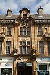 | |||
| 5 George Place | 55°50′35″N 4°25′35″W | Category B | 38986 | | |||
| Glasgow Road Barshaw Park Gatepiers And Gates | 55°50′48″N 4°23′44″W | Category C(S) | 39001 | | |||
| 7-9 (Odd) King Street And Sandholes Street "Hayweighs" | 55°50′39″N 4°26′21″W | Category B | 39030 | | |||
| 30 Mansion House Road, Greenlaw House | 55°50′57″N 4°24′40″W | Category B | 39044 | | |||
| Acer Crescent Balgonie | 55°49′44″N 4°27′07″W | Category B | 38912 | | |||
| Mile End Mill Chimney Stack | 55°50′32″N 4°24′39″W | Category B | 38918 | | |||
| Ardgowan Avenue Hunterhill House | 55°50′16″N 4°25′05″W | Category B | 38919 | | |||
| 20, 22 Back Sneddon Street And 13 Maxwell Street | 55°50′54″N 4°25′30″W | Category B | 38921 | | |||
| Broomlands Street, Woodside Cemetery, Martyrs Memorial | 55°50′37″N 4°26′33″W | Category C(S) | 38928 | | |||
| 46 Broomlands Street, Woodside Crematorium | 55°50′40″N 4°26′46″W | Category B | 38929 | | |||
| 7 Caledonia Street | 55°50′56″N 4°25′50″W | Category C(S) | 38932 | | |||
| 25-29 (Odd) Causeyside And 2 Forbes Place Paisley Co-Op | 55°50′38″N 4°25′23″W | Category B | 38938 | | |||
| 4 Dyers Wynd, Good Templar Halls And Terrace Buildings | 55°50′45″N 4°25′23″W | Category B | 38960 | | |||
| Dykebar Hospital Excluding Modern Additions | 55°49′26″N 4°23′52″W | Category B | 38961 | 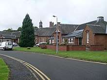 | |||
| Former Ferguslie Thread Works, Counting House | 55°50′23″N 4°26′55″W | Category B | 38965 | 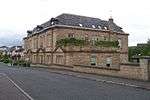 | |||
| Thornly Park, 23 South Avenue, The Gables | 55°49′33″N 4°24′53″W | Category B | 48041 | | |||
| Thornly Park, 12 And 12A Thornly Park Avenue, Thorncroft Including Boundary Walls And Gatepiers | 55°49′33″N 4°25′03″W | Category B | 48050 | | |||
| Thornly Park 22 Thornly Park Avenue, Monimail Including Boundary Walls And Gatepiers | 55°49′35″N 4°24′54″W | Category C(S) | 48051 | | |||
| 5 And 7 West Paisley Brae, Paisley | 55°50′41″N 4°26′06″W | Category B | 49026 | | |||
| Manor Park Avenue, Newark House | 55°49′41″N 4°26′45″W | Category B | 49300 | | |||
| 96 Causeyside Street | 55°50′22″N 4°25′31″W | Category B | 43735 | | |||
| Glenpatrick Road, Elderslie, East Church | 55°50′12″N 4°28′49″W | Category C(S) | 43480 | | |||
| 58 Stock Street And Espedair Street, Monty's Snooker Hall (Former Bath House) | 55°50′06″N 4°25′19″W | Category B | 43487 | | |||
| 26 New Street, Conservative Club | 55°50′38″N 4°25′31″W | Category B | 39065 | | |||
| 40 New Sneddon Street | 55°51′00″N 4°25′24″W | Category B | 39067 | | |||
| Oakshawhead Former John Neilson Institution And Entrance Lodge | 55°50′43″N 4°26′03″W | Category A | 39069 | 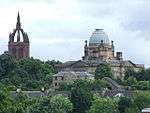 | |||
| 18 Oakshaw Street | 55°50′47″N 4°25′42″W | Category C(S) | 39081 | | |||
| 42, 44 Oakshaw Street | 55°50′46″N 4°25′52″W | Category B | 39084 | | |||
| 56 Oakshaw Street, Peter Brough District Nurses' Home | 55°50′45″N 4°25′55″W | Category B | 39086 | | |||
| 72, 74 Oakshaw | 55°50′45″N 4°26′02″W | Category C(S) | 39090 | | |||
| 121 Renfrew Road | 55°51′26″N 4°24′57″W | Category B | 39095 | | |||
| 13 School Wynd, Oakshaw | 55°50′44″N 4°25′33″W | Category C(S) | 39110 | | |||
| Stanely Road "Middle Park" | 55°49′55″N 4°26′03″W | Category C(S) | 39118 | | |||
| Stanely Road "Moredun" | 55°49′50″N 4°26′26″W | Category B | 39119 | | |||
| Anchor Buildings, Seedhill With Railings | 55°50′33″N 4°25′02″W | Category B | 39132 | | |||
| 25 Gauze Street | 55°50′47″N 4°25′09″W | Category B | 38983 | | |||
| 27 Gauze Street | 55°50′47″N 4°25′08″W | Category C(S) | 38984 | | |||
| 29-31 (Odd) Gauze Street | 55°50′47″N 4°25′07″W | Category B | 38985 | | |||
| 14 George Street St George's Church Of Scotland | 55°50′34″N 4°25′33″W | Category B | 38991 | 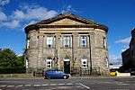 | |||
| 10, 12 Glasgow Road | 55°50′48″N 4°24′54″W | Category B | 39003 | | |||
| Gleniffer Road Macdonald's Fountain | 55°48′55″N 4°27′49″W | Category B | 39005 | | |||
| Lounsdale Road Ciba-Geigy Social Club | 55°50′21″N 4°26′32″W | Category B | 39033 | | |||
| 7 Moss Street | 55°50′45″N 4°25′29″W | Category B | 39051 | | |||
| 49, 51 Moss Street | 55°50′52″N 4°25′35″W | Category B | 39052 | | |||
| 28 Arkleston Road | 55°50′55″N 4°24′01″W | Category C(S) | 38920 | | |||
| 51 Causeyside Street | 55°50′31″N 4°25′26″W | Category B | 38943 | | |||
| Dunn Square | 55°50′42″N 4°25′23″W | Category B | 38955 | 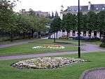 | |||
| 15-19 (Odd) Espedair Street | 55°50′18″N 4°25′24″W | Category B | 38962 | | |||
| Ferguslie Threadworks, Stables And Store On Glasgow, Paisley And Johnstone Canal | 55°50′24″N 4°26′59″W | Category C(S) | 38970 | | |||
| Thornly Park, 17 Thornly Park Avenue, Dunard Including Boundary Walls And Gatepiers | 55°49′36″N 4°25′01″W | Category B | 48043 | | |||
| Thornly Park, 2 Thornly Park Avenue, Thornly Park House | 55°49′31″N 4°25′13″W | Category C(S) | 48048 | | |||
| Thornly Park, 24 Thornly Park Avenue, Garail Including Ancillary Structure, Garden Wall And Gate | 55°49′35″N 4°24′53″W | Category C(S) | 48052 | | |||
| 17 George Street, New Jerusalem Church (Swedenborgian Church) | 55°50′33″N 4°25′39″W | Category C(S) | 50177 | | |||
| Aqueduct, Blackhall | 55°50′24″N 4°24′23″W | Category B | 44021 | | |||
| 25-31 (Odd Nos) Weighhouse Close, New Street | 55°50′39″N 4°25′36″W | Category B | 39062 | | |||
| 20 New Street | 55°50′39″N 4°25′33″W | Category B | 39063 | | |||
| 8 Oakshaw Street | 55°50′47″N 4°25′38″W | Category C(S) | 39077 | | |||
| Gateway To No 46 Oakshaw Street | 55°50′45″N 4°25′53″W | Category C(S) | 39085 | | |||
| 98-100 Renfrew Road | 55°51′18″N 4°24′57″W | Category B | 39101 | | |||
| 4 St Mirren Street | 55°50′42″N 4°25′26″W | Category B | 39106 | | |||
| 8 St Mirren Street | 55°50′42″N 4°25′25″W | Category B | 39108 | | |||
| 82 Stanely Road "Whiteleigh" | 55°49′44″N 4°26′31″W | Category B | 39122 | | |||
| 68 Falside Road, Formerly Brown And Polson Worker`S Institute | 55°49′46″N 4°25′41″W | Category B | 39136 | | |||
| 23 Gauze Street | 55°50′46″N 4°25′09″W | Category C(S) | 38982 | | |||
| 26 High Street | 55°50′43″N 4°25′34″W | Category B | 39021 | | |||
| Love Street, Lodges To Fountain Gardens | 55°51′02″N 4°25′35″W | Category C(S) | 39034 | | |||
| 32 Love Street | 55°51′00″N 4°25′34″W | Category B | 39037 | | |||
| 34, 36 (Evens) Love Street | 55°51′00″N 4°25′34″W | Category C(S) | 39038 | | |||
| 14 Main Road Castlehead "The Old House" | 55°50′20″N 4°26′08″W | Category B | 39043 | 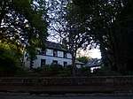 | |||
| 8-10 Moss Street | 55°50′45″N 4°25′27″W | Category C(S) | 39055 | | |||
| Blackhall Railway Viaduct Over White Cart Water | 55°50′24″N 4°24′23″W | Category A | 38923 | | |||
| Brediland Road Lounsdale House | 55°49′38″N 4°27′31″W | Category B | 38926 | | |||
| 8-10 Broomlands Street | 55°50′39″N 4°26′18″W | Category B | 38930 | | |||
| Castlehead, Main Road, Castlehead Church, Tannahill's Monument | 55°50′30″N 4°26′12″W | Category B | 38936 | 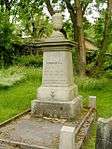 | |||
| Nos 14-20 (Even) Forbes Place | 55°50′38″N 4°25′19″W | Category B | 38977 | | |||
| Gauze Street George A Clark Statue | 55°50′44″N 4°25′18″W | Category B | 38979 | 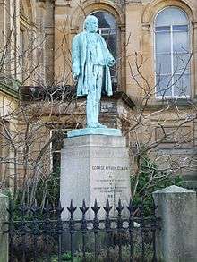 | |||
| "East Lodge", Darvel Crescent, Ralston, Paisley | 55°50′46″N 4°22′37″W | Category C(S) | 18583 | | |||
| Leethland Glenpatrick Road | 55°49′29″N 4°28′50″W | Category C(S) | 18588 | | |||
| Thornly Park, Stewart Road, Linton Including Terrace Wall | 55°49′30″N 4°25′06″W | Category B | 48042 | | |||
| 19 Lawn Street, Abbey Mission Hall | 55°50′49″N 4°25′11″W | Category C(S) | 50161 | | |||
| 5 Mansionhouse Road | 55°50′52″N 4°24′41″W | Category C(S) | 50163 | | |||
| 15 Abercorn Street, Former Oldfield's Machine Tools Warehouse | 55°50′55″N 4°25′19″W | Category C(S) | 50168 | | |||
| Hawkhead House Farm, Farmhouse | 55°49′47″N 4°23′06″W | Category C(S) | 43890 | | |||
| Cartside Mill Office Block, Milliken Park, Kilbarchan | 55°49′48″N 4°31′54″W | Category B | 43481 | | |||
| 4 New Street | 55°50′42″N 4°25′37″W | Category C(S) | 39060 | | |||
| 96 Renfrew Road | 55°51′17″N 4°24′58″W | Category C(S) | 39100 | | |||
| St James' Bridge | 55°50′44″N 4°25′21″W | Category B | 39102 | | |||
| 2 St Mirren Street | 55°50′43″N 4°25′26″W | Category B | 39105 | | |||
| Stanely Crescent, Stanely House | 55°49′35″N 4°26′57″W | Category B | 39117 | | |||
| 42 New Street | 55°50′36″N 4°25′27″W | Category C(S) | 39128 | | |||
| Abbeymill, Former Anchor Mills, Seedhill Gate House Including Gatepiers And Railings | 55°50′32″N 4°25′03″W | Category B | 39133 | 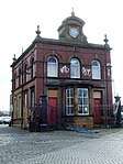 | |||
| 167 George St St Mary's Church (Rc) | 55°50′30″N 4°26′32″W | Category B | 38988 | | |||
| Greenlaw Avenue Greenlaw Church | 55°50′52″N 4°24′45″W | Category B | 39008 | 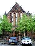 | |||
| 41 High Street And 2 New Street | 55°50′42″N 4°25′37″W | Category C(S) | 39016 | | |||
| 32 High Street Liberal Club | 55°50′43″N 4°25′37″W | Category C(S) | 39024 | | |||
| 12 Main Road Castlehead The Mound | 55°50′21″N 4°26′10″W | Category B | 39042 | | |||
| 38 Mansion House Road, Garage | 55°50′59″N 4°24′39″W | Category B | 39045 | | |||
| 85 Maxwellton Road | 55°50′26″N 4°26′58″W | Category B | 39047 | | |||
| 68 Maxwellton Road | 55°49′42″N 4°26′50″W | Category B | 39048 | | |||
| Abbey Close Place Of Paisley | 55°50′41″N 4°25′14″W | Category A | 38911 | 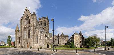 | |||
| Anchor Mills, Former No 1 Embroidery Mill | 55°50′33″N 4°24′59″W | Category B | 38916 | 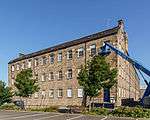 | |||
| Blackhall Street Anchor Recreation Club | 55°50′22″N 4°24′39″W | Category B | 38924 | | |||
| Castlehead, Main Road, Castlehead Church (Church Of Scotland) With Graveyard | 55°50′29″N 4°26′11″W | Category C(S) | 38935 | 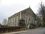 | |||
| 33 Causeyside Street And 1 Orchard Street | 55°50′36″N 4°25′24″W | Category B | 38939 | | |||
| 49 Causeyside Street | 55°50′31″N 4°25′26″W | Category C(S) | 38942 | | |||
| Church Hill And Oakshaw Street, High Church | 55°50′46″N 4°25′41″W | Category A | 38946 | 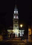 | |||
| County Square, Gilmour Street Railway Station | 55°50′50″N 4°25′28″W | Category B | 38950 | 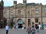 | |||
| County Square, Head Post Office | 55°50′49″N 4°25′29″W | Category B | 38952 | | |||
| Former Ferguslie Thread Works, North Gatehouse And Gates | 55°50′25″N 4°26′59″W | Category B | 38967 | | |||
| Former Ferguslie Thread Works, Tannahill's Hole | 55°50′20″N 4°26′33″W | Category C(S) | 38969 | | |||
| 27 Ferguslie And 78 Maxwellton Road | 55°50′28″N 4°26′56″W | Category B | 38971 | | |||
| Nos 4 And 6 Forbes Place | 55°50′38″N 4°25′23″W | Category C(S) | 38975 | | |||
| Thornly Park,11 South Avenue, Wilmar Including Gates | 55°49′31″N 4°25′02″W | Category C(S) | 48038 | | |||
| Thornly Park, 31 Thornly Park Avenue, Ardyne Including Gates | 55°49′38″N 4°24′48″W | Category B | 48045 | |
Key
The scheme for classifying buildings in Scotland is:
- Category A: "buildings of national or international importance, either architectural or historic; or fine, little-altered examples of some particular period, style or building type."[1]
- Category B: "buildings of regional or more than local importance; or major examples of some particular period, style or building type, which may have been altered."[1]
- Category C: "buildings of local importance; lesser examples of any period, style, or building type, as originally constructed or moderately altered; and simple traditional buildings which group well with other listed buildings."[1]
In March 2016 there were 47,288 listed buildings in Scotland. Of these, 8% were Category A, and 50% were Category B, with the remaining 42% being Category C.[2]
Notes
- Sometimes known as OSGB36, the grid reference (where provided) is based on the British national grid reference system used by the Ordnance Survey.
• "Guide to National Grid". Ordnance Survey. Retrieved 2007-12-12.
• "Get-a-map". Ordnance Survey. Retrieved 2007-12-17. - Historic Environment Scotland assign a unique alphanumeric identifier to each designated site in Scotland, for listed buildings this always begins with "LB", for example "LB12345".
gollark: Well, nobody actually makes esolangs except LyricLy.
gollark: I should implement and document osmarksISA-2028™!
gollark: Arguably five (⁵) esolang, counting osmarksISA-2028™.
gollark: Arguably 4 (four) esolang, if you count unfinished image esolang.
gollark: I have three (3) esolang, in total, I think.
References
- All entries, addresses and coordinates are based on data from Historic Scotland. This data falls under the Open Government Licence
- "What is Listing?". Historic Environment Scotland. Retrieved 29 May 2018.
- Scotland's Historic Environment Audit 2016 (PDF). Historic Environment Scotland and the Built Environment Forum Scotland. pp. 15–16. Retrieved 29 May 2018.
This article is issued from Wikipedia. The text is licensed under Creative Commons - Attribution - Sharealike. Additional terms may apply for the media files.