List of lighthouses in Sudan
Lighthouses
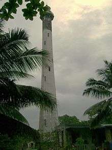
| Name | Image | Year built | Location & coordinates | Class of Light [2] | Focal height [2] | NGA number [2] | Admiralty number [2] | Range nml [2] |
|---|---|---|---|---|---|---|---|---|
| Abington Reef Lighthouse | n/a | Red Sea 20°53′39.3″N 37°27′01.8″E | Fl (2) W 18s. | 30 metres (98 ft) | 30608 | D7295.9 | 15 | |
| Damma Damma Lighthouse | n/a | Port Sudan 19°35′46.8″N 37°14′35.1″E | Q R | 8 metres (26 ft) | 30632 | D7295.6 | 6 | |
| Hindi Gider Lighthouse | n/a | Suakin 19°23′00.0″N 37°54′48.0″E | Fl (2) W 20s. | 27 metres (89 ft) | 30684 | D7295.031 | 10 | |
| Masamirit Lighthouse | n/a | Suakin 18°49′48.0″N 38°45′36.0″E | Fl W 10s. | 26 metres (85 ft) | 30688 | D7295.03 | 10 | |
| Port Sudan Entrance Lighthouse | n/a | Port Sudan 19°35′21.0″N 37°14′55.6″E | Fl (2) W 10s. | 19 metres (62 ft) | 30636 | D7295.5 | 10 | |
| Port Sudan Harbor Range Front Lighthouse | 2004 | Port Sudan 19°36′41.9″N 37°13′26.1″E | F R (neon) | 36 metres (118 ft) | 30648 | D7295.65 | n/a | |
| Port Sudan Harbor Range Rear Lighthouse | 2004 | Port Sudan 19°36′59.9″N 37°12′58.7″E | F R (neon) | 53 metres (174 ft) | 30652 | D7295.655 | n/a | |
| Sanganeb Reef Lighthouse | 1906 est. | Red Sea 19°43′24.2″N 37°26′32.5″E | Fl W 5s. | 50 metres (160 ft) | 30612 | D7295.8 | 19 | |
| Wingate Reef East Lighthouse | n/a | Red Sea 19°38′40.5″N 37°19′26.7″E | Fl (3) W 15s. | 7 metres (23 ft) | 30620 | D7295.79 | 6 | |
| Wingate Reef South Lighthouse | n/a | Red Sea 19°37′05.2″N 37°17′15.1″E | Fl G 3s. | 8 metres (26 ft) | 30616 | D7295.78 | 6 | |
gollark: Yes.
gollark: Macron idea: Macron can generate Macron at Macron time.
gollark: Macron idea: references to pointers to functions.
gollark: Macron idea: Minoteaur is a builtin.
gollark: Macron idea: numerical solutions to differential equations.
See also
- List of lighthouses in Egypt (to the north)
- List of lighthouses in Eritrea (to the south-east)
- Lists of lighthouses and lightvessels
References
- Sudan The Lighthouse Directory. University of North Carolina at Chapel Hill. Retrieved 28 September 2016
- List of Lights, Pub. 112: Western Pacific and Indian Oceans Including the Persian Gulf and Red Sea (PDF). List of Lights. United States National Geospatial-Intelligence Agency. 2016. Retrieved 28 September 2016
External links
- Rowlett, Russ. "The Lighthouse Directory". University of North Carolina at Chapel Hill.
| Types |
| _-_cropped.jpg) | ||||
|---|---|---|---|---|---|---|
| Fixtures | ||||||
| Maintenance | ||||||
| Locations | ||||||
| Categories |
| |||||
| Global organizations | ||||||
| ||||||
Lists of lighthouses in Africa | ||||||
|---|---|---|---|---|---|---|
| Sovereign states |
|  | ||||
This article is issued from Wikipedia. The text is licensed under Creative Commons - Attribution - Sharealike. Additional terms may apply for the media files.