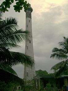
List of lighthouses in Mayotte
Lighthouses
| Name | Image | Year built | Location & coordinates | Class of Light [2] | Focal height[2] | NGA number[2] | Admiralty number[2] | Range nml[2] |
|---|---|---|---|---|---|---|---|---|
| Cap Douamougno Lighthouse | n/a | 12°39′10.6″S 45°06′16.6″E | Iso WRG 4s. | 109 metres (358 ft) | 32777 | D6891 | 10 | |
| Île Mtsongoma Range Front Lighthouse | n/a | 12°41′21.8″S 45°07′43.8″E | V Q WRG | 28 metres (92 ft) | 32777.2 | D6892 | white: 10 red: 7 green: 7 | |
| Île Mtsongoma Range Rear Lighthouse | n/a | 12°42′03.9″S 45°07′48.3″E | V Q W | 45 metres (148 ft) | 32777.21 | D6892.1 | 11 | |
| Isle Blanche Lighthouse | n/a | 12°43′06.2″S 45°10′25.1″E | V Q W | 10 metres (33 ft) | 32777.5 | D6894 | 9 | |
| Pamanzi range Front Lighthouse | n/a | 12°46′24.0″S 45°16′24.0″E | V Q W | 11 metres (36 ft) | 32766 | D6894.6 | 12 | |
| Passage Bandrélé Range Front Lighthouse | n/a | 12°52′34.8″S 45°13′03.0″E | Q R | 21 metres (69 ft) | 32768 | D6900 | 5 | |
| Passage Bandrélé Range Front Lighthouse | n/a | 12°52′31.4″S 45°12′54.6″E | Q R | 54 metres (177 ft) | 32772 | D6900.1 | 5 | |
| Récif Vaucluse Lighthouse | n/a | 12°39′22.9″S 45°07′16.8″E | Fl (4) G 15s. | 9 metres (30 ft) | 32777.4 | D6892.5 | 4 | |
gollark: Anyone interested in a Minetest (yes, Mine*test*) web server management thing? I've got it to do terminal access now, but I plan to add a start/stop button, very simple `minetest.conf` editor, and log viewer.
gollark: Presumably these are weird unbranded DIMMs of some sort?
gollark: I use a combination of GNU/Linux and not running random untrusted binaries.
gollark: Really? That explains a lot.
gollark: The games I like tend to be small because they rely more on interesting gameplay than increasingly shiny graphics.
See also
- Lists of lighthouses and lightvessels
References
- Mayotte The Lighthouse Directory. University of North Carolina at Chapel Hill. Retrieved 22 September 2016
- List of Lights, Pub. 112: Western Pacific and Indian Oceans Including the Persian Gulf and Red Sea (PDF). List of Lights. United States National Geospatial-Intelligence Agency. 2016. Retrieved 22 September 2016
External links
- Rowlett, Russ. "The Lighthouse Directory". University of North Carolina at Chapel Hill.
This article is issued from Wikipedia. The text is licensed under Creative Commons - Attribution - Sharealike. Additional terms may apply for the media files.
_-_cropped.jpg)
