List of lighthouses in Guinea
Lighthouses
| Name | Image | Year built | Location & coordinates | Class of Light [2] | Focal height[2] | NGA number[2] | Admiralty number[2] | Range nml[2] |
|---|---|---|---|---|---|---|---|---|
| Boulbinet Lighthouse | 1906 | 9°30′10.18″N 13°43′11.1″W | Oc (2) WR 12s. | 13 metres (43 ft) | 24636 | D3093 | white: 12 red: 10 | |
| Cap Gonzales Lighthouse | n/a | 10°24′16.2″N 14°41′21.1″W | Fl (3) W 15s. | 10 metres (33 ft) | 24612 | D3087 | 15 | |
| Cap Verga Lighthouse | n/a | 10°15′06.5″N 14°26′24.4″W | Fl (2) W 10s. | 120 metres (390 ft) | 24616 | D3088 | 20 | |
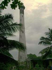
| Conakry Dique de la Prudente Lighthouse | n/a | 9°30′34.6″N 13°43′20.2″W | VQ (6) L Fl W 10s. | 13 metres (43 ft) | 24640 | D3094 | 7 | |
| Île Matakong Lighhtouse | 1902 | 9°16′02.1″N 13°25′48.7″W | Iso W 4s. | 21 metres (69 ft) | 24648 | D3096 | 6 | |
| Île Tamara Lighthouse | 1906 | 9°27′28.7″N 13°50′01.1″W | Fl W 5s. | 95 metres (312 ft) | 24620 | D3090 | 26 | |
gollark: Is there a good bignums library which works in CC? I want to make https://github.com/qntm/base1/blob/master/index.js.
gollark: lollollollol,loLlollollollollollol,LoLlollollollollollol,LoLlollollollollollol,LoLlollollollollollol,LoLlollollollollollol,loLlollollollollollol,LoLlollollollollollol,lOLlollollollollollol, lollollollollollollollOLlollollollollollollolLOllollollollollollollOLLoLLOLlOLlollollolLoLlollollollollollollol:lollollollollollolLollollollollollollollollOl lOLlOLlOL:LOLlOllOllollOLLOLlOLLoLlOL;lOLLoLLOLlOllOLLolLOLloLlOL:LOLlOllOl.lollollol lollollollollollollol:lollollollollollollol#lollollollollollollOl lOLlOLlOL:LOLlOllOllolLOLLOlLOLloLlOLLolLOLloLlOLLoLlOl.lollollol lollollollollollollol:lollollollollollollol;lollollollollollollOl lOLlOLlOL:LOLlOllOllollOLLOllOL:lOL;LOLloLLOLlOllOL:lOL#lOl.lollollol lollollollollollollol:lollollollollollollolLOllollollollollollolloL.loLloLlollollol.lollollollollollollol,lollollollollollollolLoLlollollollollollolLOLlolLOLlOllOL:lOLLOllollollol.lollollollollollollol,lollollollollollollollOllollollollollollollol?lollollollollollolLOLlolLOLlOllOL:lOLLOllOLLoLLOLLOlLOLLOllOLLoLLOLLOllollollolLoLlollollollollollolLOLloLlOL.lOLLOllOL!lollol
gollark: Lol!loL#LOLLoLlOLLolLoLLollollollolLollolloLlolloLlolloLlol lollollol.lollollollollollolloLlolLOLLOlLOLloLlOLLolLOLlOlLOLloLLOLLoLLOLlollollol,Lollollollollollollol, lollollollollollollollOllollollollollol.LolLollollollollollollollol?lollollollollollolloLLoLlollollollollollolloLlOLloLlol#lollollolLoL#lollol lollollollOllOlloLlollollollollolloLLoL lollollollollol loLlollollollollollolLoL#lollollolLollolLolLollOL#lollollol lol loLlolLol lollollol#lollolLol lollollOllollollollOllollollollol.#loLLol lollolLollOLLol lollollollollolLollOLloLlol:;LOL:LollOL#lol:!LOL:Lol;lollol lollollollolLOllollollollollollollolloLlol?lollollollollollollOLLOllOL:LOLlOllOL:LOLLoLLOLloLlOL.lOL;lOLLoLlollollolloLlollOLlollollollollollolLOL.lOL.lOLLoLlOL#lOLloLlollollolloLlollOLlollollollollollolLOLlollOLLollOL.LOLlOlLOLLOllollollollollollollollollollolLolLollollollollollollol,LOllollollollollollol,LOllollollollollollol,LOllollollollollollol,LOllollollollollollol,LOllollollollollollol,loLlollollollollollol,loLlollollollollollol,loLlollol
gollark: One byte input -> two to six bytes of lolcrypt.
gollark: I did. It's just that it gets exponentially more slow for each run, since lolcrypt inflates the size lots.
See also
- List of lighthouses in Guinea-Bissau (to the north)
- List of lighthouses in Sierra Leone (to the south)
- Lists of lighthouses and lightvessels
References
- Guinea The Lighthouse Directory. University of North Carolina at Chapel Hill. Retrieved 17 September 2016
- List of Lights, Pub. 113: The West Coasts of Europe and Africa, the Mediterranean Sea, Black Sea and Azovskoye More (Sea of Azov) (PDF). List of Lights. United States National Geospatial-Intelligence Agency. 2016. Retrieved 22 September 2016
External links
Rowlett, Russ. "The Lighthouse Directory". University of North Carolina at Chapel Hill.
| Types |
| _-_cropped.jpg) | ||||
|---|---|---|---|---|---|---|
| Fixtures | ||||||
| Maintenance | ||||||
| Locations | ||||||
| Categories |
| |||||
| Global organizations | ||||||
| ||||||
Lists of lighthouses in Africa | ||||||
|---|---|---|---|---|---|---|
| Sovereign states |
|  | ||||
This article is issued from Wikipedia. The text is licensed under Creative Commons - Attribution - Sharealike. Additional terms may apply for the media files.