Les Basques Regional County Municipality
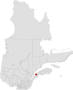
Les Basques (the Basques) is a regional county municipality in the Bas-Saint-Laurent region in eastern Quebec, Canada. It is located on the south bank of the Saint Lawrence River halfway between Rimouski and Rivière-du-Loup.
Les Basques | |
|---|---|
 | |
| Coordinates: 48°06′N 69°04′W[1] | |
| Country | Canada |
| Province | Quebec |
| Region | Bas-Saint-Laurent |
| Effective | April 1, 1981 |
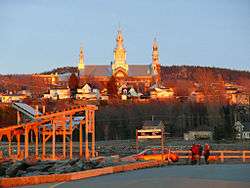
| County seat | Trois-Pistoles |
| Government | |
| • Type | Prefecture |
| • Prefect | Bertin Denis |
| Area | |
| • Total | 1,130.70 km2 (436.57 sq mi) |
| • Land | 1,121.82 km2 (433.14 sq mi) |
| Population (2016)[3] | |
| • Total | 8,694 |
| • Density | 7.7/km2 (20/sq mi) |
| • Change 2011-2016 | |
| • Dwellings | 5,185 |
| Time zone | UTC−05:00 (EST) |
| • Summer (DST) | UTC−04:00 (EDT) |
| Area code(s) | 418 and 581 |
| Website | www |
The county seat is in Trois-Pistoles.
Subdivisions
There are 12 subdivisions within the RCM:[2]
|
|
|
|
Demographics
Population
| Canada census – Les Basques Regional County Municipality community profile | |||
|---|---|---|---|
| 2016 | 2011 | 2006 | |
| Population: | 8,694 (-4.9% from 2011) | 9,142 (-3.5% from 2006) | 9,475 (-3.8% from 2001) |
| Land area: | 1,121.82 km2 (433.14 sq mi) | 1,122.76 km2 (433.50 sq mi) | 1,122.76 km2 (433.50 sq mi) |
| Population density: | 7.7/km2 (20/sq mi) | 8.1/km2 (21/sq mi) | 8.4/km2 (22/sq mi) |
| Median age: | 55.6 (M: 55.1, F: 56.1) | 52.6 (M: 51.7, F: 53.5) | 48.4 (M: 47.3, F: 49.7) |
| Total private dwellings: | 5,185 | 5,144 | 5,121 |
| Median household income: | $44,809 | $42,510 | $34,859 |
| References: 2016[4] 2011[5] 2006[6] earlier[7] | |||
|
|
Language
| Canada Census Mother Tongue - Les Basques Regional County Municipality, Quebec[8][3] | ||||||||||||||||||
|---|---|---|---|---|---|---|---|---|---|---|---|---|---|---|---|---|---|---|
| Census | Total | French |
English |
French & English |
Other | |||||||||||||
| Year | Responses | Count | Trend | Pop % | Count | Trend | Pop % | Count | Trend | Pop % | Count | Trend | Pop % | |||||
2016 |
8,580 |
8,530 | 99.42% | 30 | 0.35% | 10 | 0.12% | 10 | 0.12% | |||||||||
2011 |
9,055 |
8,980 | 99.17% | 50 | 0.55% | 20 | 0.22% | 5 | 0.06% | |||||||||
2006 |
9,125 |
8,970 | 98.30% | 15 | 0.17% | 0 | 0.00% | 140 | 1.53% | |||||||||
2001 |
9,580 |
9,545 | 99.64% | 25 | 0.26% | 0 | 0.00% | 10 | 0.10% | |||||||||
1996 |
9,920 |
9,805 | n/a | 98.84% | 95 | n/a | 0.96% | 20 | n/a | 0.20% | 0 | n/a | 0.00% | |||||
Transportation
Access Routes
.jpg)
Highways and numbered routes that run through the municipality, including external routes that start or finish at the county border:[9]
gollark: I think the biggest issue is that any system doing it is either going to have a central authority or some sort of web-of-trust-y federated model, and it might be possible for some groups to just completely discard votes from people they don't like.
gollark: Decentralized vote counting is... nontrivial, but probably possible.
gollark: You *can* do direct democracy.
gollark: Distributed systems design is hard even when you can trust all the things involved.
gollark: Approximately. I think you need some sort of central resolution for *some* things.
References
- Reference number 141074 of the Commission de toponymie du Québec (in French)
- Geographic code 110 in the official Répertoire des municipalités (in French)
- "Census Profile, 2016 Census: Les Basques, Municipalité régionale de comté [Census division], Quebec". Statistics Canada. Retrieved December 18, 2019.
- "2016 Community Profiles". 2016 Canadian Census. Statistics Canada. February 21, 2017. Retrieved 2019-12-18.
- "2011 Community Profiles". 2011 Canadian Census. Statistics Canada. July 5, 2013. Retrieved 2014-01-27.
- "2006 Community Profiles". 2006 Canadian Census. Statistics Canada. March 30, 2011. Retrieved 2013-05-25.
- "2001 Community Profiles". 2001 Canadian Census. Statistics Canada. February 17, 2012.
- Statistics Canada: 1996, 2001, 2006, 2011 census
- Official Transport Quebec Road Map
Adjacent Counties & Equivalent Territories | |
|---|---|
| Regional county municipalities and equivalent territories | |
|---|---|
| Municipalities |
|
This article is issued from Wikipedia. The text is licensed under Creative Commons - Attribution - Sharealike. Additional terms may apply for the media files.