Saint-Jean-de-Dieu
Saint-Jean-de-Dieu is a municipality in Quebec, Canada. The municipality had a population of 1,606 in the Canada 2011 Census.
Saint-Jean-de-Dieu | |
|---|---|
Municipality | |
.jpg) | |
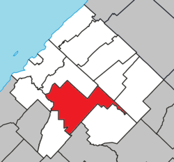 Location within Les Basques RCM | |
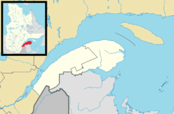 Saint-Jean-de-Dieu Location in eastern Quebec | |
| Coordinates: 48°N 69.05°W[1] | |
| Country | |
| Province | |
| Region | Bas-Saint-Laurent |
| RCM | Les Basques |
| Constituted | January 1, 1865 |
| Government | |
| • Mayor | Jean-Marie Côté |
| • Federal riding | Rimouski-Neigette—Témiscouata —Les Basques |
| • Prov. riding | Rivière-du-Loup-Témiscouata |
| Area | |
| • Total | 151.60 km2 (58.53 sq mi) |
| • Land | 151.02 km2 (58.31 sq mi) |
| Population (2011)[3] | |
| • Total | 1,606 |
| • Density | 10.6/km2 (27/sq mi) |
| • Pop 2006-2011 | |
| • Dwellings | 740 |
| Time zone | UTC−5 (EST) |
| • Summer (DST) | UTC−4 (EDT) |
| Postal code(s) | G0L 3M0 |
| Area code(s) | 418 and 581 |
| Highways | |
| Website | www |
The two main settlements within the municipality are the communities of Saint-Jean-de-Dieu and La Société. The settlement of Saint-Jean-de-Dieu was counted by Statistics Canada as a designated place in the 2011 census, separately from the boundaries of the municipality as a whole, and had a population of 935.
Demographics
Population
| Canada census – Saint-Jean-de-Dieu community profile | |||
|---|---|---|---|
| 2011 | 2006 | ||
| Population: | 1,606 (-3.9% from 2006) | 1,671 (-5.5% from 2001) | |
| Land area: | 151.02 km2 (58.31 sq mi) | 151.02 km2 (58.31 sq mi) | |
| Population density: | 10.6/km2 (27/sq mi) | 11.1/km2 (29/sq mi) | |
| Median age: | 50.2 (M: 49.8, F: 50.6) | 46.5 (M: 45.6, F: 47.5) | |
| Total private dwellings: | 740 | 740 | |
| Median household income: | $39,983 | $36,016 | |
| References: 2011[4] 2006[5] earlier[6] | |||
| Year | Pop. | ±% |
|---|---|---|
| 1991 | 1,893 | — |
| 1996 | 1,828 | −3.4% |
| 2001 | 1,768 | −3.3% |
| 2006 | 1,671 | −5.5% |
| 2011 | 1,606 | −3.9% |
Language
| Canada Census Mother Tongue - Saint-Jean-de-Dieu, Quebec[7] | ||||||||||||||||||
|---|---|---|---|---|---|---|---|---|---|---|---|---|---|---|---|---|---|---|
| Census | Total | French |
English |
French & English |
Other | |||||||||||||
| Year | Responses | Count | Trend | Pop % | Count | Trend | Pop % | Count | Trend | Pop % | Count | Trend | Pop % | |||||
2011 |
1,570 |
1,570 | 100.00% | 0 | 0.00% | 0 | 0.00% | 0 | 0.00% | |||||||||
2006 |
1,580 |
1,565 | 99.05% | 0 | 0.00% | 0 | 0.00% | 15 | 0.95% | |||||||||
2001 |
1,710 |
1,710 | 100.00% | 0 | 0.00% | 0 | 0.00% | 0 | 0.00% | |||||||||
1996 |
1,765 |
1,720 | n/a | 97.45% | 35 | n/a | 1.98% | 10 | n/a | 0.57% | 0 | n/a | 0.00% | |||||
gollark: Oh, well, I meant something like "producing bees" or maybe "utilizing bees".
gollark: No. I will. Not.
gollark: Ubgroducingt beds.
gollark: Alternatively, there just aren't that many people with the relevant skillsets who aren't doing other things, and none of them care about it/have gotten around to it.
gollark: Cheaper/easier personalization presumably.
See also
References
- Reference number 56877 of the Commission de toponymie du Québec (in French)
- Geographic code 11010 in the official Répertoire des municipalités (in French)
- "(Code 2411010) Census Profile". 2011 census. Statistics Canada. 2012.
- "2011 Community Profiles". 2011 Canadian Census. Statistics Canada. July 5, 2013. Retrieved 2014-03-10.
- "2006 Community Profiles". 2006 Canadian Census. Statistics Canada. March 30, 2011. Retrieved 2014-03-10.
- "2001 Community Profiles". 2001 Canadian Census. Statistics Canada. February 17, 2012.
- Statistics Canada: 1996, 2001, 2006, 2011 census
External links

Adjacent Municipal Subdivisions | ||||||||||
|---|---|---|---|---|---|---|---|---|---|---|
| ||||||||||
| Cities & Towns | |
|---|---|
| Municipalities |
|
| Parishes | |
| Unorganized territories | |
| |
This article is issued from Wikipedia. The text is licensed under Creative Commons - Attribution - Sharealike. Additional terms may apply for the media files.