Le Larderet
Le Larderet is a commune in the Jura department in Franche-Comté in eastern France.
Le Larderet | |
|---|---|
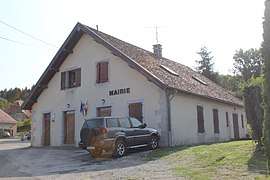 The town hall in Le Larderet | |
Location of Le Larderet 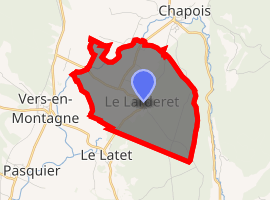
| |
 Le Larderet  Le Larderet | |
| Coordinates: 46°49′03″N 5°56′55″E | |
| Country | France |
| Region | Bourgogne-Franche-Comté |
| Department | Jura |
| Arrondissement | Lons-le-Saunier |
| Canton | Champagnole |
| Government | |
| • Mayor (2014–2020) | Véronique Del Do |
| Area 1 | 6.31 km2 (2.44 sq mi) |
| Population (2017-01-01)[1] | 74 |
| • Density | 12/km2 (30/sq mi) |
| Time zone | UTC+01:00 (CET) |
| • Summer (DST) | UTC+02:00 (CEST) |
| INSEE/Postal code | 39277 /39300 |
| Elevation | 590–796 m (1,936–2,612 ft) |
| 1 French Land Register data, which excludes lakes, ponds, glaciers > 1 km2 (0.386 sq mi or 247 acres) and river estuaries. | |
Population
| Year | Pop. | ±% |
|---|---|---|
| 1793 | 172 | — |
| 1806 | 176 | +2.3% |
| 1821 | 213 | +21.0% |
| 1831 | 226 | +6.1% |
| 1841 | 261 | +15.5% |
| 1851 | 221 | −15.3% |
| 1861 | 214 | −3.2% |
| 1872 | 180 | −15.9% |
| 1881 | 170 | −5.6% |
| 1891 | 140 | −17.6% |
| 1901 | 139 | −0.7% |
| 1911 | 133 | −4.3% |
| 1921 | 110 | −17.3% |
| 1931 | 93 | −15.5% |
| 1946 | 78 | −16.1% |
| 1954 | 87 | +11.5% |
| 1962 | 58 | −33.3% |
| 1968 | 60 | +3.4% |
| 1975 | 52 | −13.3% |
| 1982 | 48 | −7.7% |
| 1990 | 63 | +31.2% |
| 1999 | 72 | +14.3% |
| 2006 | 71 | −1.4% |
| 2012 | 90 | +26.8% |
gollark: ¡¡¡
gollark: I should probably fix helloboisite™.
gollark: While I agree with the sentiment, GEORGE is actually infinitely dense.
gollark: This is however bad.
gollark: You could chain markoviously.
See also
References
- "Populations légales 2017". INSEE. Retrieved 6 January 2020.
| Wikimedia Commons has media related to Le Larderet. |
| Authority control |
|
|---|
This article is issued from Wikipedia. The text is licensed under Creative Commons - Attribution - Sharealike. Additional terms may apply for the media files.