Charnod
Charnod is a commune in the Jura department in Franche-Comté in eastern France.
Charnod | |
|---|---|
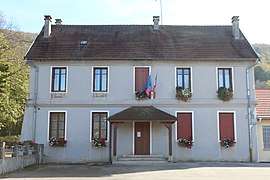 The town hall in Charnod | |
Location of Charnod 
| |
 Charnod  Charnod | |
| Coordinates: 46°20′03″N 5°29′25″E | |
| Country | France |
| Region | Bourgogne-Franche-Comté |
| Department | Jura |
| Arrondissement | Lons-le-Saunier |
| Canton | Moirans-en-Montagne |
| Government | |
| • Mayor (2014–2020) | Micheline Colin |
| Area 1 | 5.17 km2 (2.00 sq mi) |
| Population (2017-01-01)[1] | 40 |
| • Density | 7.7/km2 (20/sq mi) |
| Time zone | UTC+01:00 (CET) |
| • Summer (DST) | UTC+02:00 (CEST) |
| INSEE/Postal code | 39111 /39240 |
| Elevation | 480–685 m (1,575–2,247 ft) |
| 1 French Land Register data, which excludes lakes, ponds, glaciers > 1 km2 (0.386 sq mi or 247 acres) and river estuaries. | |
Population
| Year | Pop. | ±% |
|---|---|---|
| 1793 | 194 | — |
| 1806 | 198 | +2.1% |
| 1821 | 137 | −30.8% |
| 1831 | 155 | +13.1% |
| 1841 | 154 | −0.6% |
| 1851 | 150 | −2.6% |
| 1861 | 151 | +0.7% |
| 1872 | 157 | +4.0% |
| 1881 | 157 | +0.0% |
| 1891 | 158 | +0.6% |
| 1901 | 139 | −12.0% |
| 1911 | 140 | +0.7% |
| 1921 | 109 | −22.1% |
| 1931 | 93 | −14.7% |
| 1946 | 100 | +7.5% |
| 1954 | 93 | −7.0% |
| 1962 | 82 | −11.8% |
| 1968 | 62 | −24.4% |
| 1982 | 57 | −8.1% |
| 1990 | 50 | −12.3% |
| 1999 | 43 | −14.0% |
| 2006 | 49 | +14.0% |
| 2012 | 44 | −10.2% |
gollark: Shut up, qez.
gollark: I don't want to feel railroaded into one endgame mod.
gollark: But Avaritia is just stupid and unbalanced.
gollark: All else being equal it's best to not have a mod, because RAM use.
gollark: Yes there is.
See also
References
- "Populations légales 2017". INSEE. Retrieved 6 January 2020.
| Wikimedia Commons has media related to Charnod. |
| Authority control |
|
|---|
This article is issued from Wikipedia. The text is licensed under Creative Commons - Attribution - Sharealike. Additional terms may apply for the media files.