Le Cours
Le Cours (Ar C'hour in Breton) is a commune in the Morbihan department of Brittany in north-western France.
Le Cours Ar C'hour | |
|---|---|
.svg.png) Coat of arms | |
Location of Le Cours 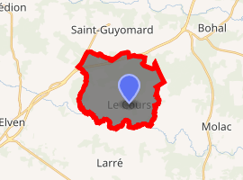
| |
 Le Cours  Le Cours | |
| Coordinates: 47°44′33″N 2°30′00″W | |
| Country | France |
| Region | Brittany |
| Department | Morbihan |
| Arrondissement | Vannes |
| Canton | Questembert |
| Intercommunality | Pays de Questembert |
| Government | |
| • Mayor (2008—2014) | Paul Soulard |
| Area 1 | 15.63 km2 (6.03 sq mi) |
| Population (2017-01-01)[1] | 670 |
| • Density | 43/km2 (110/sq mi) |
| Time zone | UTC+01:00 (CET) |
| • Summer (DST) | UTC+02:00 (CEST) |
| INSEE/Postal code | 56045 /56230 |
| Elevation | 27–106 m (89–348 ft) |
| 1 French Land Register data, which excludes lakes, ponds, glaciers > 1 km2 (0.386 sq mi or 247 acres) and river estuaries. | |
Geography
The river Arz forms all of the commune's southern border.
Demographics
Inhabitants of Le Cours are called in French Coursiens.
gollark: Trouble with # is that it triggers a backdoor I got into cobalt which installs PotatOS.
gollark: CC++C#C+#+C##C#++#
gollark: C + "++" = C++C++ + "++" = C#
gollark: const int //globalvar = 50;
gollark: I'll make my own PotatoPass system tomorrow with ACTUAL SECURE PASSWORD HANDLING.
See also
References
- "Populations légales 2017". INSEE. Retrieved 6 January 2020.
- Mayors of Morbihan Association (in French)
- INSEE commune file
External links
| Wikimedia Commons has media related to Le Cours. |
- Official site (in French)
| Authority control |
|
|---|
This article is issued from Wikipedia. The text is licensed under Creative Commons - Attribution - Sharealike. Additional terms may apply for the media files.