Férel
Férel (Ferel in Breton) is a commune in the Morbihan department of Brittany in north-western France.
Férel Ferel | |
|---|---|
.svg.png) Coat of arms | |
Location of Férel 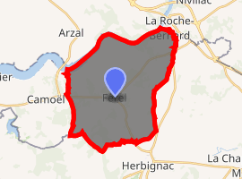
| |
 Férel  Férel | |
| Coordinates: 47°28′59″N 2°20′33″W | |
| Country | France |
| Region | Brittany |
| Department | Morbihan |
| Arrondissement | Vannes |
| Canton | Muzillac |
| Intercommunality | Presqu'île de Guérande-Atlantique |
| Government | |
| • Mayor (2008—2014) | Patrick Bastien |
| Area 1 | 28.90 km2 (11.16 sq mi) |
| Population (2017-01-01)[1] | 3,220 |
| • Density | 110/km2 (290/sq mi) |
| Time zone | UTC+01:00 (CET) |
| • Summer (DST) | UTC+02:00 (CEST) |
| INSEE/Postal code | 56058 /56130 |
| Elevation | 0–52 m (0–171 ft) |
| 1 French Land Register data, which excludes lakes, ponds, glaciers > 1 km2 (0.386 sq mi or 247 acres) and river estuaries. | |
Demographics
Inhabitants of Férel are called in French Férélais.
gollark: * salt inferno
gollark: The salt inferno sounds cooler.
gollark: My keyboard's suggestion row now shows "I" and "Pagination" when I start a sentence.
gollark: People have to constantly repost them to keep them visible.
gollark: Well, basically, you can only see the most recent few trades.
See also
- La Baule - Guérande Peninsula
- Communes of the Morbihan department
References
- "Populations légales 2017". INSEE. Retrieved 6 January 2020.
- Mayors of Morbihan Association (in French)
- INSEE commune file
External links
| Wikimedia Commons has media related to Férel. |
- Official site (in French)
| Authority control |
|
|---|
This article is issued from Wikipedia. The text is licensed under Creative Commons - Attribution - Sharealike. Additional terms may apply for the media files.