Guilliers
Guilliers (Breton: Gwiler-Porc'hoed) is a commune in the Morbihan department of Brittany in north-western France.
Guilliers Gwiler-Porc'hoed | |
|---|---|
.svg.png) Coat of arms | |
Location of Guilliers 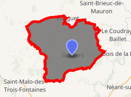
| |
 Guilliers  Guilliers | |
| Coordinates: 48°02′36″N 2°24′15″W | |
| Country | France |
| Region | Brittany |
| Department | Morbihan |
| Arrondissement | Pontivy |
| Canton | Ploërmel |
| Intercommunality | Porhoët |
| Government | |
| • Mayor (2008—2014) | Michèle Urien |
| Area 1 | 35.14 km2 (13.57 sq mi) |
| Population (2017-01-01)[1] | 1,313 |
| • Density | 37/km2 (97/sq mi) |
| Time zone | UTC+01:00 (CET) |
| • Summer (DST) | UTC+02:00 (CEST) |
| INSEE/Postal code | 56080 /56490 |
| Elevation | 47–114 m (154–374 ft) |
| 1 French Land Register data, which excludes lakes, ponds, glaciers > 1 km2 (0.386 sq mi or 247 acres) and river estuaries. | |
Demographics
Inhabitants of Guilliers are called in French Guilliérois.
gollark: I'm interacting with a Laptop item.
gollark: I do not like this Pandemic event, it's basically just a copy of the previous ones with some minor tweaks.
gollark: Also r/outside.
gollark: What does that even mean?
gollark: Why not proof of proof?
See also
References
- "Populations légales 2017". INSEE. Retrieved 6 January 2020.
- Mayors of Morbihan Association (in French)
- INSEE commune file
| Wikimedia Commons has media related to Guilliers. |
| Authority control |
|
|---|
This article is issued from Wikipedia. The text is licensed under Creative Commons - Attribution - Sharealike. Additional terms may apply for the media files.