La Bigottière
La Bigottière is a commune in the Mayenne department in northwestern France.
La Bigottière | |
|---|---|
Location of La Bigottière 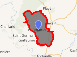
| |
 La Bigottière  La Bigottière | |
| Coordinates: 48°13′10″N 0°47′52″W | |
| Country | France |
| Region | Pays de la Loire |
| Department | Mayenne |
| Arrondissement | Mayenne |
| Canton | Ernée |
| Government | |
| • Mayor (2008–2014) | Claude Tarlevé |
| Area 1 | 18.40 km2 (7.10 sq mi) |
| Population (2017-01-01)[1] | 498 |
| • Density | 27/km2 (70/sq mi) |
| Time zone | UTC+01:00 (CET) |
| • Summer (DST) | UTC+02:00 (CEST) |
| INSEE/Postal code | 53031 /53240 |
| Elevation | 93–183 m (305–600 ft) (avg. 150 m or 490 ft) |
| 1 French Land Register data, which excludes lakes, ponds, glaciers > 1 km2 (0.386 sq mi or 247 acres) and river estuaries. | |
Population
| Year | Pop. | ±% |
|---|---|---|
| 1962 | 461 | — |
| 1968 | 407 | −11.7% |
| 1975 | 383 | −5.9% |
| 1982 | 342 | −10.7% |
| 1990 | 349 | +2.0% |
| 1999 | 331 | −5.2% |
| 2009 | 431 | +30.2% |
gollark: Oh no, potatOS is very secure, and *not* through obscurity.
gollark: * commented
gollark: It's all public and (not that well, to be honest) commeted.
gollark: MIT-licensed, you can fork it.
gollark: Look, the main code is all right here, other stuff is... well, it's spread across a lot of files, but you can see it, check the `local files = whatever` bit and my pastebin account.
See also
- Communes of Mayenne
References
- "Populations légales 2017". INSEE. Retrieved 6 January 2020.
| Wikimedia Commons has media related to La Bigottière. |
| Authority control |
|
|---|
This article is issued from Wikipedia. The text is licensed under Creative Commons - Attribution - Sharealike. Additional terms may apply for the media files.