Alexain
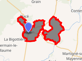
Alexain is a commune in the Mayenne department in northwestern France. It is 20 km northwest of Laval and 14 km from Mayenne. The nearest communes are La Bigottière, Placé, and Saint-Germain-d'Anxure.
Alexain | |
|---|---|
Location of Alexain 
| |
 Alexain  Alexain | |
| Coordinates: 48°13′47″N 0°46′00″W | |
| Country | France |
| Region | Pays de la Loire |
| Department | Mayenne |
| Arrondissement | Mayenne |
| Canton | Mayenne |
| Intercommunality | Mayenne Communauté |
| Government | |
| • Mayor (2014-2020) | Ernest Guihery |
| Area 1 | 16.24 km2 (6.27 sq mi) |
| Population (2017-01-01)[1] | 601 |
| • Density | 37/km2 (96/sq mi) |
| Time zone | UTC+01:00 (CET) |
| • Summer (DST) | UTC+02:00 (CEST) |
| INSEE/Postal code | 53002 /53240 |
| Elevation | 72–167 m (236–548 ft) (avg. 140 m or 460 ft) |
| 1 French Land Register data, which excludes lakes, ponds, glaciers > 1 km2 (0.386 sq mi or 247 acres) and river estuaries. | |
Population
| Year | Pop. | ±% |
|---|---|---|
| 2006 | 450 | — |
| 2007 | 478 | +6.2% |
| 2008 | 505 | +5.6% |
| 2009 | 535 | +5.9% |
| 2010 | 564 | +5.4% |
| 2011 | 594 | +5.3% |
| 2012 | 609 | +2.5% |
| 2013 | 616 | +1.1% |
| 2014 | 610 | −1.0% |
| 2015 | 605 | −0.8% |
| 2016 | 599 | −1.0% |
Sights
The nearby Château de la Feuillée, long-term home of the d'Orenge family, was destroyed during the French Revolution and was rebuilt in 1809.
gollark: That is a YouTube video.
gollark: * superior
gollark: Bow to my superiot TeX.
gollark: =tex \sum_{n=0}^{\infty}\frac{1}{n}
gollark: No ohio.
See also
- Communes of Mayenne
References
- "Populations légales 2017". INSEE. Retrieved 6 January 2020.
| Wikimedia Commons has media related to Alexain. |
This article is issued from Wikipedia. The text is licensed under Creative Commons - Attribution - Sharealike. Additional terms may apply for the media files.