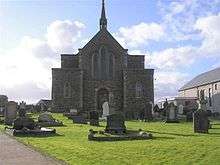
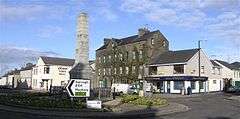
Kilrea
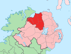
Kilrea (/kɪlˈreɪ/ kil-RAY, from Irish: Cill Ria, meaning "church on the hill")[1][2] is a village, townland and civil parish in County Londonderry, Northern Ireland. It gets its name from the ancient church that was located near to where the current Church of Ireland is located on Church Street looking over the town. It is near the River Bann, which marks the boundary between County Londonderry and County Antrim. In the 2011 Census it had a population of 2,724 people.[3] It is situated within Causeway Coast and Glens district.
Kilrea
| |
|---|---|
 | |
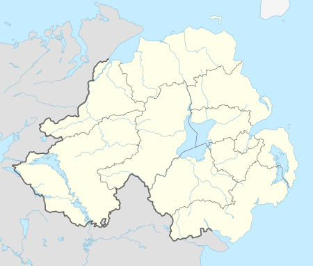 Location within Northern Ireland | |
| Population | 2,724 (2011 Census) |
| District | |
| County | |
| Country | Northern Ireland |
| Sovereign state | United Kingdom |
| Post town | COLERAINE |
| Postcode district | BT51 |
| Dialling code | 028 |
| UK Parliament | |
| NI Assembly | |
History
There is a tradition that St Patrick visited the area during the fifth century, a story repeated recently in the book 'The Fairy Thorn' produced by Kilrea local historians. During the Plantation of Ulster Kilrea and the surrounding townlands were granted to the Worshipful Company of Mercers by King James I for settlement.[4] Their headquarters in Ulster were at nearby Movanagher on the banks of the River Bann. Today Kilrea is a market town and commercial centre of the surrounding district. The village is centred on 'The Diamond' which includes the town's War Memorial erected in honour of Kilrea men killed in the Great War.[5] The village is featured in the Orange song, Sprigs of Kilrea. It is also mentioned in the song Kitty the rose of Kilrea by The Irish Rover band.
The Troubles
A total of seven people died in violence relating to the Troubles. Five were killed by the Provisional Irish Republican Army (IRA) and two by the Ulster Freedom Fighters (UFF). All the IRA's victims were current or former members of the security forces, with two belonging to the Royal Ulster Constabulary, one a current and one a former member of the Ulster Defence Regiment, and one belonging to the British Territorial Army. All were Protestants and three of the five were off duty when they were killed. According to the Sutton Index of Deaths, both men killed by the UFF were former members of the IRA. At the time of their deaths both were associated with Sinn Féin. Both were Catholic. Of the seven killed in the Kilrea Troubles, all were killed in separate incidents and all were shot except one of the RUC officers, who was killed by a booby trap bomb while on patrol. While deaths in many other areas were concentrated in the early 1970s, in Kilrea they were spread between 1976 and 1992.[6]
Festival of the Fairy Thorn
A feature of Kilrea is its 'Fairy Thorn' tree, which stands just outside the front wall of First Kilrea Presbyterian Church. It is the focal point of the annual summer cross-community festival in the town.[7]
Notable People
- Martin O'Neill, ex professional footballer and ex-manager of Nottingham Forest FC
- John Dallat, first nationalist mayor of the Borough of Coleraine
- Monica McWilliams, academic and former politician
Railways
Kilrea railway station was opened by the Derry Central Railway on 18 February 1880.[8] It was taken over by the Northern Counties Committee in September 1901.
The station closed to passengers on 28 August 1950 by the Ulster Transport Authority.
Sport
- Kilrea Angling Club
- Kilrea Camogie Club
- Kilrea Golf Club
- Kilrea Pádraig Pearses GAC
- Kilrea United Football Club
- Manor Golf and Sports Club
- Go Pro Kart Racing Movanagher Road
- Kilrea Sports Complex
Education
- Kilrea Primary School
- St Columba's Primary School
- St Paul's College
- Crossroads Primary School
Religion
- Boveedy Presbyterian Church
- First Kilrea Presbyterian Church
- Kilrea Baptist Church
- Second Kilrea Presbyterian Church
- St Anne's Roman Catholic Church[9]
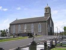
- St Patrick's Church of Ireland
- St. Mary’s Roman Catholic Church
2011 Census
Kilrea is classified as an Intermediate Settlement by the NI Statistics and Research Agency (NISRA) (i.e., with population between 2,250 and 4,500 people). On Census day (22 March 2011) there were 2,724 people living in Kilrea. Of these:
- 23.27% were aged under 16 years and 14.5% were aged 60 and over
- 50.77% of the population were male and 49.23% were female
- 67.11% were from a Catholic background and 29.77% were from a Protestant background
- 6.46% of people aged 16–74 were unemployed
For more details see the match of location name: @Exact Match Of Location Name: Kilrea@4?
References
- "Placenames NI". placenamesni.org. Archived from the original on 27 July 2012. Retrieved 22 April 2018.
- "Cill Ria/Kilrea". Logainm.ie. Retrieved 22 April 2018.
- Agency, Northern Ireland Statistics and Research. "statistics". www.ninis2.nisra.gov.uk. Retrieved 22 April 2018.
- "Lewis's Topographical Directory of Ireland, 1837". from-ireland.net. Archived from the original on 6 December 2008. Retrieved 22 April 2018.
- "Ulster War Memorials". ulsterwarmemorials.net. Archived from the original on 20 August 2008. Retrieved 22 April 2018.
- Sutton, Malcolm. "CAIN: Sutton Index of Deaths - menu page". cain.ulst.ac.uk. Retrieved 22 April 2018.
- Kilrea, Coleraine Archived 2010-06-24 at the Wayback Machine Northern Ireland Tourist Board website
- "Kilrea station" (PDF). Railscot - Irish Railways. Retrieved 29 April 2012.
- "Kilrea Parish - Derry Diocese, Ireland". derrydiocese.org. Archived from the original on 31 December 2008. Retrieved 22 April 2018.
External links
| Wikimedia Commons has media related to Kilrea. |
