Kerian District
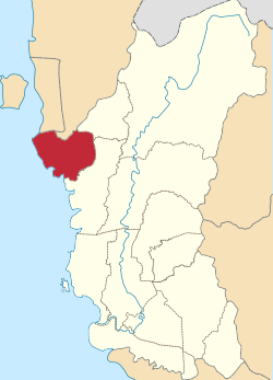
The Kerian District (alternately Krian) is an administrative district in Perak, Malaysia. It covers the northwestern corner of Perak, bordering the states of Penang and Kedah to the north; the main town of Parit Buntar is located a mere 37 km (23 mi) southeast of George Town, Penang's capital city.
Kerian District | |
|---|---|
| Daerah Kerian | |
| Other transcription(s) | |
| • Chinese | 吉辇县 |
| • Tamil | கிரியான் |
 Location of Kerian District in Perak | |
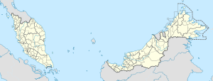
 Kerian District Location of Kerian District in Malaysia | |
| Coordinates: 5°0′N 100°30′E | |
| Country | |
| State | |
| Seat | Parit Buntar |
| Local area government(s) | Kerian District Council (Main place) Taiping Municipal Council (Southerneast part) |
| Government | |
| • District officer | Sabli Bakri[1] |
| Area | |
| • Total | 921.47 km2 (355.78 sq mi) |
| Population (2010)[3] | |
| • Total | 176,683 |
| • Estimate (2015)[4] | 190,700 |
| • Density | 190/km2 (500/sq mi) |
| Time zone | UTC+8 (MST) |
| • Summer (DST) | UTC+8 (Not observed) |
| Postcode | 34200-34400 |
| Calling code | +6-05 |
| Vehicle registration plates | A |
Due to its closer proximity to Penang, much of Kerian is also part of Greater Penang, Malaysia's second largest conurbation.
The district is one of the main rice-growing areas in Perak.[5]
Administrative divisions

Kerian District is divided into eight mukims, which are:[6]
- Bagan Serai
- Bagan Tiang
- Beriah
- Gunong Semanggol
- Kuala Kurau
- Parit Buntar
- Selinsing
- Tanjung Piandang
Demographics
The following is based on Department of Statistics Malaysia 2010 census.[3]
| Ethnic groups in Kerian , 2010 census | ||
|---|---|---|
| Ethnicity | Population | Percentage |
| Bumiputera | 130,903 | 74.8% |
| Chinese | 30,517 | 17.3% |
| Indian | 13,893 | 8.1% |
| Others | 1,395 | 0.2% |
| Total | 176,683 | 100% |
Federal Parliament and State Assembly Seats
List of Kerian district representatives in the Federal Parliament (Dewan Rakyat)
| Parliament | Seat Name | Member of Parliament | Party |
|---|---|---|---|
| P57 | Parit Buntar | Mujahid Yusof Rawa | Pakatan Harapan (AMANAH) |
| P58 | Bagan Serai | Noor Azmi Ghazali | Perikatan Nasional (PPBM) |
List of Kerian district representatives in the State Legislative Assembly of Perak
| Parliament | State | Seat Name | State Assemblyman | Party |
|---|---|---|---|---|
| P57 | N8 | Titi Serong | Hasnul Zulkarnain Bin Abd Munaim | Perikatan Nasional (PPBM) |
| P57 | N9 | Kuala Kurau | Abdul Yunus Jamahri | Perikatan Nasional (PPBM) |
| P58 | N10 | Alor Pongsu | Sham Mat Sahat | Perikatan Nasional (BN-UMNO) |
| P58 | N11 | Gunong Semanggol | Razman Bin Zakaria | Perikatan Nasional (PAS) |
| P58 | N12 | Selinsing | Mohamad Noor Bin Dawoo | Perikatan Nasional (BN-UMNO) |
References
- "Laman Web Pejabat Daerah Dan Tanah Kerian - Perutusan Pegawai Daerah". pdtkerian.perak.gov.my.
- "Rancangan Struktur Negeri Perak 2040" (PDF). Archived from the original (PDF) on 2018-03-28. Retrieved 2018-03-28.
- "Population Distribution and Basic Demographic Characteristics, 2010" (PDF). Department of Statistics, Malaysia. Archived from the original (PDF) on 22 May 2014. Retrieved 19 April 2012.
- "Rancangan Struktur Negeri Perak 2040" (PDF). p. 316. Archived from the original (PDF) on 2018-03-28. Retrieved 2018-03-28.
- ASLIE, A. MALEK. "6 tan sehektar". M.utudasn.com.my. Retrieved 2017-02-24.
- "Prof@ail.daerah" (PDF). Apps.water.gov.my. Retrieved 2017-02-24.