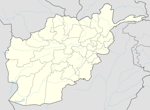
Kamdesh District
Kamdesh District[2] (Kamdeish District, Pashto: کامدېش ولسوالۍ, Persian: ولسوالی کامدیش) is a district of Nuristan Province in eastern Afghanistan,[3] sharing a name with the town of Kamdesh. It was originally in Kunar Province[4] and then was moved to the newly created Nuristan Province in 2001.
Kamdesh | |
|---|---|
District | |
 Kamdesh Location within Afghanistan | |
| Coordinates: 35°29′00″N 71°19′00″E | |
| Country | |
| Province | Nuristan Province |
| Population (2010) | |
| • Total | 24,500[1] |
Boundaries
Since March 2004, Kamdesh District borders on:[3]
- Bargi Matal District to the north,
- Pakistan to the east,
- Ghaziabad District and Nari District of Kunar Province to the south,
- Waygal District to the southwest, and
- Parun District to the west.
gollark: I'm not really sure about what do after A-level, and am also vaguely unsure about my subject choices for that, but *oh well* (I technically can still change them, though).
gollark: I have no idea if you *need* it here, but university is quite popular.
gollark: I think that might be allowed too, actually? But you need to be in some sort of training thing.
gollark: You are not, apparently, legally allowed to do full-time work until you're 18, and must be in education/training of some kind.
gollark: It looks simpler than your diagram, although I suppose that covers all school stuff while I'm only talking about my specific school and there are other options like vocational training of some kind.
See also
- Battle of Kamdesh, 2009
Notes
- "Nuristan Provincial Profile" (PDF). Minister of Rural Rehabilitation and Development. Retrieved 27 August 2015.
- Kāmdēsh (Approved) at GEOnet Names Server, United States National Geospatial-Intelligence Agency
- "Afghanistan Administrative Divisions" Archived 2010-09-23 at the Wayback Machine map, March 2007, Afghanistan Information Management Services (AIMS)
- "Afghanistan" political map, 1986, United States Central Intelligence Agency
This article is issued from Wikipedia. The text is licensed under Creative Commons - Attribution - Sharealike. Additional terms may apply for the media files.