Jose P. Laurel Highway
Jose P. Laurel Highway, officially named as Manila–Batangas Road, is a 49-kilometer (30 mi), two-to-six lane, major highway running within the province of Batangas.[1][2][3] The highway forms part of National Route 4 (N4) of the Philippine highway network.
| ||||
|---|---|---|---|---|
| Manila–Batangas Road | ||||
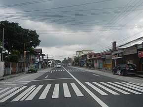 Jose P. Laurel Highway in Malvar, Batangas | ||||
| Route information | ||||
| Maintained by Department of Public Works and Highways | ||||
| Length | 49 km (30 mi) | |||
| Component highways | ||||
| Major junctions | ||||
| North end | ||||
| ||||
| South end | ||||
| Location | ||||
| Provinces | Batangas | |||
| Major cities | Santo Tomas, Tanauan, Lipa, Batangas City | |||
| Towns | Malvar, San Jose | |||
| Highway system | ||||
| ||||
.svg.png)
The highway was named in the honor of Jose P. Laurel, a Batangas native who served as first president of the Second Philippine Republic.
History
Route description
The Southern Tagalog Arterial Road mostly parallels the highway, and crosses each other at Lipa.
Intersections
The entire route is located in Batangas. Intersections are numbered by kilometer posts, with Rizal Park in Manila designated as kilometer zero.
| City/Municipality | km | mi | Destinations | Notes | |
|---|---|---|---|---|---|
| Santo Tomas | Northern terminus | ||||
| Governor Carpio Avenue | |||||
| Santo Tomas Bypass Road | |||||
| Santo Tomas–Tanauan boundary | San Juan Bridge over San Juan River | ||||
| Tanauan | Traffic light intersection. Serves St. John the Evangelist Parish and La Consolacion College Tanauan. | ||||
| Malvar | Pedro Montecer Street – STAR Tollway | ||||
| Lipa | Leviste Road – Alaminos | ||||
| F. Leviste Highway – STAR Tollway, Balete | |||||
| Alaminos–Lipa Road – Alaminos, San Pablo | Serves Fiesta World Mall, Kolehiyo ng Lungsod ng Lipa, and Stonyhurst Southville International School. | ||||
| Roundabout. Eastern end of Ayala Highway. | |||||
| Roundabout. Western end of Ayala Highway. | |||||
| Serves Fernando Air Base. | |||||
| Mataaskahoy Road – Mataasnakahoy | |||||
| San Jose | Charito Makalintal Avenue – San Jose town proper, Ibaan | ||||
| Makalintal Avenue / Pulgeras Road – San Jose town proper, Alitagtag, Bauan | |||||
| Makalintal Avenue – San Jose town proper | |||||
| Batangas City | |||||
| Southern terminus. Traffic light intersection | |||||
| 1.000 mi = 1.609 km; 1.000 km = 0.621 mi | |||||
gollark: That is not what I meant.
gollark: Possibly. I may be able to get one before then.
gollark: Kind of regretting giving away my garland. Now I can't get another. Stupid cave.
gollark: I think the actual IRC protocol is full of ridiculous stuff and legacy cruft anyway, but I like the *concept*.
gollark: Discord is entirely centralized, all your stuff is just hosted on their servers.
References
- "Batangas 2nd". www.dpwh.gov.ph. Retrieved June 8, 2018.
- "Batangas 3rd". www.dpwh.gov.ph. Retrieved June 8, 2018.
- "Batangas 4th". www.dpwh.gov.ph. Retrieved June 8, 2018.
External links
| Expressways |
| ||||||
|---|---|---|---|---|---|---|---|
| National highways |
| ||||||
| National primary roads |
| |||||||
|---|---|---|---|---|---|---|---|---|
| National secondary roads |
| |||||||
See also: Philippine expressway network | ||||||||
This article is issued from Wikipedia. The text is licensed under Creative Commons - Attribution - Sharealike. Additional terms may apply for the media files.