Johnston Parish, New Brunswick
Johnston Parish is a civil parish[lower-alpha 1] in Queens County, New Brunswick, Canada.[2]
Johnston | |
|---|---|
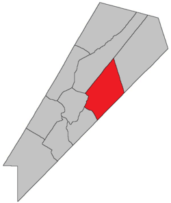 Location within Queens County, New Brunswick. | |
| Coordinates: 45.84°N 64.59°W | |
| Country | |
| Province | |
| County | Queens County |
| Established | 1839 |
| Area | |
| • Land | 359.32 km2 (138.73 sq mi) |
| Population (2016)[1] | |
| • Total | 560 |
| • Density | 1.6/km2 (4/sq mi) |
| • Change 2011-2016 | |
| • Dwellings | 392 |
| Time zone | UTC-4 (AST) |
| • Summer (DST) | UTC-3 (ADT) |
For governance purposes it is divided between the village of Cambridge-Narrows and the local service district of the parish of Johnston.[3]
History
Johnston Parish was established in 1839 from Wickham Parish, and was named for Hugh Johnston (1790-1850), who was a Member of the Legislative Assembly of New Brunswick. His father, Hugh Johnston (1756-1829), was also a Member of the Legislative Assembly.
Delineation
Johnston Parish is defined in the Territorial Division Act'[2] as being bounded:
- Southwest by Wickham and Cambridge Parishes; northwest by the prolongation of a line running north fifty-four degrees east by the magnet of the year one thousand seven hundred and eighty-six, from the west angle of the grant to Samuel Hughes, at Lower Cambridge; east by the east line of lot number eleven, granted to A.C. Starrit, on the north side of the Canaan River above Coles Island and its northern and southern prolongation, and southeast by the County line.
Communities
Parish population total does not include incorporated municipalities (in bold).
|
|
|
Bodies of water & Islands
This is a list of rivers, lakes, streams, creeks, marshes and Islands that are at least partially in this parish
Demographics
Access Routes
Highways and numbered routes that run through the parish, including external routes that start or finish at the parish limits:[6]
|
|
|
|
See also
Notes
- Civil parishes served a variety of government functions until 1966, when the new Municipalities Act stripped them of their responsibilities; they continue to provide convenient boundaries for government uses, especially electoral districts and local service districts. Statistics Canada uses civil parishes as census subdivisions for all parts of the province that are not within municipalities and similar entities.
References
- "Census Profile, 2016 Census Johnston, Parish [Census subdivision], New Brunswick". Statistics Canada. Retrieved September 27, 2019.
- "Chapter T-3 Territorial Division Act". Government of New Brunswick. Retrieved 22 July 2020.
- "New Brunswick Regulation 84-168 under the Municipalities Act (O.C. 84-582)". Government of New Brunswick. Retrieved 19 July 2020.
- Statistics Canada: 2001, 2006 census
- 2011 Statistics Canada Census Profile: Johnston Parish, New Brunswick
- Atlantic Canada Back Road Atlas ISBN 978-1-55368-618-7
Places adjacent to Johnston Parish, New Brunswick | |
|---|---|
| Subdivisions |
|
|---|---|
| Cities | |
| Counties | |
| |