Wickham Parish, New Brunswick
Wickham is a civil parish[lower-alpha 1] in Queens County, New Brunswick, Canada.[2]
Wickham | |
|---|---|
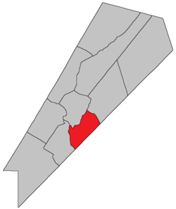 Location within Queens County, New Brunswick. | |
| Country | |
| Province | |
| County | Queens County |
| Established | 1786 |
| Area | |
| • Land | 160.34 km2 (61.91 sq mi) |
| Population (2016)[1] | |
| • Total | 427 |
| • Density | 2.7/km2 (7/sq mi) |
| • Change 2011-2016 | |
| • Dwellings | 469 |
| Time zone | UTC-4 (AST) |
| • Summer (DST) | UTC-3 (ADT) |
For governance purposes it is divided between the village of Cambridge-Narrows and the local service district of the parish of Wickham.[3]
History
Wickham Parish was established in 1786: possibly named for William Spry, a prominent settler who came from the town of Wickham, Hampshire County, England: Wickham Parish included Johnston Parish until 1839 and part of Cambridge Parish until 1852.
Delineation
Wickham Parish is defined in the Territorial Division Act[2] as being bounded:
- Southeast by the County line; west by the Saint John River; northwest by Cambridge Parish; and northeast by the centre of the road[lower-alpha 2] leading from Washademoak Lake to Springfield, including the Lower Musquash and Hog Islands, and the eastern half of Long Island, to be determined by a line running lengthwise through the centre of the island, from the head to the foot of the same.
Communities
Parish population total does not include incorporated municipalities (in bold).
|
|
|
Bodies of water & Islands
This is a list of rivers, lakes, streams, creeks, marshes and Islands that are at least partially in this parish
- Long Island
- Hog Island
- Saint John River
- Hampstead Ferry
Demographics
Access Routes
Highways and numbered routes that run through the parish, including external routes that start or finish at the parish limits:[7]
See also
Notes
- Civil parishes served a variety of government functions until 1966, when the new Municipalities Act stripped them of their responsibilities; they continue to provide convenient boundaries for government uses, especially electoral districts and local service districts. Statistics Canada uses civil parishes as census subdivisions for all parts of the province that are not within municipalities and similar entities.
- Watson Road and part of Route 695[4]
References
- "Census Profile, 2016 Census Wickham, Parish [Census subdivision], New Brunswick". Statistics Canada. Retrieved September 27, 2019.
- "Chapter T-3 Territorial Division Act". Government of New Brunswick. Retrieved 22 July 2020.
- "New Brunswick Regulation 84-168 under the Municipalities Act (O.C. 84-582)". Government of New Brunswick. Retrieved 19 July 2020.
- "No. 413" (PDF). 2015 Designated Highway Maps. Government of New Brunswick. Retrieved 30 August 2016.
- Statistics Canada: 2001, 2006 census
- 2011 Statistics Canada Census Profile: Wickham Parish, New Brunswick
- Atlantic Canada Back Road Atlas ISBN 978-1-55368-618-7
Places adjacent to Wickham Parish, New Brunswick | |
|---|---|
| Subdivisions |
|
|---|---|
| Cities | |
| Counties | |
| |