Studholm Parish, New Brunswick
Studholm is a civil parish[lower-alpha 1] in Kings County, New Brunswick, Canada.[2] For governance purposes it forms the local service district of the parish of Studholm,[3] which further includes the service area of Lower Millstream.[3]
Studholm | |
|---|---|
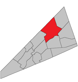 Location within Kings County, New Brunswick. | |
| Coordinates: 45.84°N 64.59°W | |
| Country | |
| Province | |
| County | Kings County |
| Established | 1840 |
| Area | |
| • Land | 449.37 km2 (173.50 sq mi) |
| Population (2016)[1] | |
| • Total | 3,522 |
| • Density | 7.8/km2 (20/sq mi) |
| • Pop 2011-2016 | |
| • Dwellings | 1,481 |
| Time zone | UTC-4 (AST) |
| • Summer (DST) | UTC-3 (ADT) |
History
Studholm Parish established in 1840 from Sussex Parish: named for Gilfred Studholme (1740-1792), the commander at Fort Howe in 1783 and a settler in the area: Studholm Parish included Havelock Parish until 1858.
Delineation
Studholm Parish is defined in the Territorial Division Act[4] as being bounded:
- West by Springfield Parish and the line running north from the mouth of the Halfway Brook; northwest by the County line; east by the western side line of the grant of nine hundred and ninety-seven acres to Thomas Leonard, the northern prolongation thereof to the County line, and the southerly prolongation thereof to Windgap Brook; thence following the several courses of said brook down stream until it intersects a line running south forty-two degrees thirty minutes east by the magnet of the year one thousand eight hundred and thirty-nine from the southwest angle of lot number one south granted to James Caruth; thence following the said last-mentioned line prolonged to Cardwell Parish, and south by Sussex and Cardwell Parishes.
Communities
Parish population total does not include incorporated municipalities (in bold).
|
|
|
Bodies of water & Islands
This is a list of rivers, lakes, streams, creeks, marshes and Islands that are at least partially in this parish
- None
Demographics
Population
| Canada census – Studholm Parish, New Brunswick community profile | |||
|---|---|---|---|
| 2016 | 2011 | 2006 | |
| Population: | 3,522 (-2.5% from 2011) | 3,612 (+2.4% from 2006) | 3,526 (-5.2% from 2001) |
| Land area: | 449.37 km2 (173.50 sq mi) | 449.43 km2 (173.53 sq mi) | 449.43 km2 (173.53 sq mi) |
| Population density: | 7.8/km2 (20/sq mi) | 8.0/km2 (21/sq mi) | 7.8/km2 (20/sq mi) |
| Median age: | 45.9 (M: 45.6, F: 46.0) | 43.0 (M: 42.9, F: 43.0) | 40.8 (M: 41.0, F: 40.7) |
| Total private dwellings: | 1,481 | 1,459 | 1,382 |
| Median household income: | $61,248 | $53,700 | $44,605 |
| References: 2016[5] 2011[6] 2006[7] earlier[8] | |||
|
|
| |||||||||||||||||||||||||||
| [9][1] | |||||||||||||||||||||||||||||
Language
| Canada Census Mother Tongue - Studholm Parish, New Brunswick[9] | ||||||||||||||||||
|---|---|---|---|---|---|---|---|---|---|---|---|---|---|---|---|---|---|---|
| Census | Total | English |
French |
English & French |
Other | |||||||||||||
| Year | Responses | Count | Trend | Pop % | Count | Trend | Pop % | Count | Trend | Pop % | Count | Trend | Pop % | |||||
2011 |
3,545 |
3,425 | 96.61% | 45 | 1.27% | 15 | 0.42% | 60 | 1.69% | |||||||||
2006 |
3,480 |
3,335 | 95.83% | 15 | 0.43% | 15 | 0.43% | 115 | 3.30% | |||||||||
2001 |
3,670 |
3,590 | 97.82% | 50 | 1.36% | 10 | 0.27% | 20 | 0.54% | |||||||||
1996 |
3,705 |
3,625 | n/a | 97.84% | 35 | n/a | 0.94% | 10 | n/a | 0.27% | 35 | n/a | 0.94% | |||||
Access Routes
Highways and numbered routes that run through the parish, including external routes that start or finish at the parish limits:[10]
|
|
|
|
See also
Notes
- Civil parishes served a variety of government functions until 1966, when the new Municipalities Act stripped them of their responsibilities; they continue to provide convenient boundaries for government uses, especially electoral districts and local service districts. Statistics Canada uses civil parishes as census subdivisions for all parts of the province that are not within municipalities and similar entities.
References
- "Census Profile, 2016 Census Studholm, Parish [Census subdivision], New Brunswick". Statistics Canada. Retrieved August 27, 2019.
- "Chapter T-3 Territorial Division Act". Government of New Brunswick. Retrieved 19 July 2020.
- "New Brunswick Regulation 84-168 under the Municipalities Act (O.C. 84-582)". Government of New Brunswick. Retrieved 19 July 2020.
- "Territorial Division Act (R.S.N.B. 1973, c. T-3)". Government of New Brunswick website. Retrieved 26 August 2016.
- "2016 Community Profiles". 2016 Canadian Census. Statistics Canada. February 21, 2017. Retrieved 2019-08-27.
- "2011 Community Profiles". 2011 Canadian Census. Statistics Canada. July 5, 2013. Retrieved 2014-03-27.
- "2006 Community Profiles". 2006 Canadian Census. Statistics Canada. March 30, 2011. Retrieved 2014-03-27.
- "2001 Community Profiles". 2001 Canadian Census. Statistics Canada. February 17, 2012.
- Statistics Canada: 1996, 2001, 2006, 2011 census
- Atlantic Canada Back Road Atlas ISBN 978-1-55368-618-7 Pages 4, 12
Places adjacent to Studholm Parish, New Brunswick | |
|---|---|
| Subdivisions |
|
|---|---|
| Cities | |
| Counties | |
| |