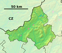
Jablonka, Myjava District
Jablonka is a village and municipality in the Myjava District in the Trenčín Region of West Slovakia. The name Jablonka literally translates as a 'small apple tree', which can be explained by the large number of apple trees in and around the village.
Jablonka | |
|---|---|
Village | |
 Jablonka Location of Jablonka in the Trenčín Region  Jablonka Jablonka (Slovakia) | |
| Coordinates: 48°43′29″N 17°36′35″E | |
| Country | Slovakia |
| Region | Trenčín |
| District | Myjava |
| First mentioned | 1955 |
| Area | |
| • Total | 12.587 km2 (4.860 sq mi) |
| Elevation | 290 m (950 ft) |
| Population | |
| • Total | 516 |
| • Density | 41/km2 (110/sq mi) |
| Postal code | 906 21 |
| Car plate | MY |
| Website | www.jablonka.sk |
History
In historical records the village was first mentioned in 1955.
Geography
The municipality lies at an altitude of 290 metres and covers an area of 12.587 km². It has a population of about 516 people. The small villages in Jablonka consist of U maliarikovci, U usiiacovci and U michalickovci.
gollark: If you have an introspection module…
gollark: If you do, the kinetic augment will activate and fly you around wildly.
gollark: No you can't.
gollark: What is the problem with that?
gollark: It does yes.
External links
![]()
- Official page
- https://web.archive.org/web/20071027094149/http://www.statistics.sk/mosmis/eng/run.html
This article is issued from Wikipedia. The text is licensed under Creative Commons - Attribution - Sharealike. Additional terms may apply for the media files.