Kostolné
Kostolné (Hungarian: Nagyegyházas) is a village and municipality in Myjava District in the Trenčín Region of western Slovakia.
Kostolné | |
|---|---|
Village | |
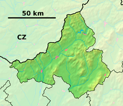 Kostolné Location of Kostolné in the Trenčín Region  Kostolné Kostolné (Slovakia) | |
| Coordinates: 48°43′58″N 17°42′23″E | |
| Country | Slovakia |
| Region | Trenčín |
| District | Myjava |
| First mentioned | 1392 |
| Area | |
| • Total | 10.109 km2 (3.903 sq mi) |
| Elevation | 219 m (719 ft) |
| Population | |
| • Total | 640 |
| • Density | 63/km2 (160/sq mi) |
| Postal code | 906 21 |
| Car plate | MY |
| Website | www.obeckostolne.estranky.sk |
History
In historical records the village was first mentioned in 1392.
Geography
The municipality lies at an altitude of 219 metres and covers an area of 10.109 km². It has a population of about 640 people.
Genealogical resources
The records for genealogical research are available at the state archive "Statny Archiv in Bratislava, Slovakia"
- Lutheran church records (births/marriages/deaths): 1784-1924 (parish A)
gollark: I had a Christian teacher teaching Christianity one time, it was very annoying.
gollark: "religious culture" teachers really shouldn't be allowed to speak about the religion they believe in. Or its schisms.
gollark: Well, seems just as stupid as Islam itself, I guess.
gollark: I found the wïkipedia entry, never mind. It seems like an offshoot of Islam which really likes the Qur'an.
gollark: <@341618941317349376>
External links
- Official page
- https://web.archive.org/web/20090412234949/http://www.statistics.sk/mosmis/eng/run.html
- Surnames of living people in Kostolne
Municipalities of Myjava District | ||
|---|---|---|
This article is issued from Wikipedia. The text is licensed under Creative Commons - Attribution - Sharealike. Additional terms may apply for the media files.