Inishfarnard
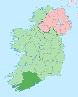
Inishfarnard (Irish: Inis Fearn Ard) meaning Island of the tall fern is a small island and a townland[2] off Kilcatherine Point, in County Cork, Ireland.
| Native name: Inis Fearn Ard[1] | |
|---|---|
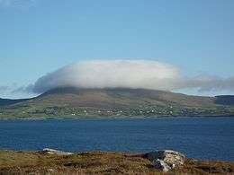
 Panoramic view | |
 Inishfarnard | |
| Geography | |
| Location | Atlantic Ocean |
| Coordinates | 51°42′38.4″N 10°1′32.2″W |
| Area | 0.3296 km2 (0.1273 sq mi)[2] |
| Highest elevation | 45.1 m (148 ft)[3] |
| Administration | |
| Province | Munster |
| County | Cork |
| Demographics | |
| Population | 0 |
Geography

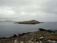
Near the northern tip of the island there are pleasant cliffs; the best landing place for boats (not suitable for kayaks) is located on the SE side of the island, near a fish farm. Freshwater, which was once available on the island, cannot be found anymore.[4]
History
A small community of 24 used to live on the island,[4] which is now uninhabited, with its old houses abandoned as well as the neighbouring fields.
Fishing
Inishfarnard is considered a good place for fishing.[4] A fish farm now operates in the waters on the southeast of the island[5], it is operated by Mowi[6]
See also
References
- "Inis Fearn Ard". Placenames Database of Ireland. Dublin City University. Retrieved July 9, 2016.
- "Inishfarnard Townland, Co. Cork". Townlands.ie. p. 539. Retrieved July 10, 2016.
- British Islands Pilot. Hydrographic office under the authority of the secretary of the navy. 1923. p. 310. Retrieved July 10, 2016.
- David Walsh (2004). Oileain: A Guide to the Irish Islands. Pesda Press. p. 79. Retrieved July 11, 2016.
- Oileain web edition
- Marine harvest Ireland
![]()
