Harvey Parish, New Brunswick
Harvey is a civil parish[lower-alpha 1] in Albert County, New Brunswick, Canada. For governance purposes it forms the local service district of the parish of Harvey.
Harvey | |
|---|---|
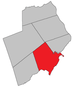 Location within Albert County. | |
| Coordinates: 45.72°N 64.78°W | |
| Country | |
| Province | |
| County | Albert |
| Established | 1786 |
| Area | |
| • Land | 277.27 km2 (107.05 sq mi) |
| Population (2016)[1] | |
| • Total | 333 |
| • Density | 1.2/km2 (3/sq mi) |
| • Pop 2011-2016 | |
| • Dwellings | 248 |
| Time zone | UTC-4 (AST) |
| • Summer (DST) | UTC-3 (ADT) |
History
Harvey Parish created in 1838 from part of Hopewell Parish and a small portion of St. John County and named for Sir John Harvey (1777-1852), lieutenant-governor of New Brunswick from 1837-1841: Harvey Parish included Alma Parish until 1855.
Delineation
Harvey Parish is defined in the Territorial Division Act[2] as being bounded:
- North by a line running south seventy-two degrees west from the northwest angle of Hopewell Parish; west by the western line of lot number three, granted to James Speer, east of Owls Head, and its northerly prolongation to the northern line of the parish; east by Hopewell Parish, and south by Chignecto Bay, including Grindstone Island, so called.
Governance
The entire parish forms the local service district of the parish of Harvey, established in 1966 to assess for fire protection. First aid and ambulance services were added to the assessment in 1976 and recreational facilities in 1992.
Communities
Parish population total does not include incorporated municipalities (in bold).
|
|
|
Bodies of water & Islands
This is a list of rivers, lakes, streams, creeks, marshes and Islands that are at least partially in this parish
- Petitcodiac River
- Shepody River
Demographics
Access Routes
Highways and numbered routes that run through the parish, including external routes that start or finish at the parish limits:[5]
See also
Notes
- Civil parishes served a variety of government functions until 1966, when the new Municipalities Act stripped them of their responsibilities; parishes continue to provide convenient boundaries for federal and provincial electoral districts. Statistics Canada uses civil parishes as census subdivisions for all parts of the province that are not within municipalities and similar entities.
References
- "Census Profile, 2016 Census: Harvey, Parish [Census subdivision], New Brunswick". Statistics Canada. Retrieved September 4, 2019.
- "Territorial Division Act (R.S.N.B. 1973, c. T-3)". Government of New Brunswick website. Retrieved 23 August 2016.
- Statistics Canada: 2001, 2006 census
- 2011 Statistics Canada Census Profile: Harvey Parish, New Brunswick
- Atlantic Canada Back Road Atlas ISBN 978-1-55368-618-7
Places adjacent to Harvey Parish, New Brunswick | |
|---|---|
| Subdivisions |
|
|---|---|
| Cities | |
| Counties | |
| |