Alma Parish, New Brunswick
Alma is a civil parish[lower-alpha 1] in Albert County, New Brunswick, Canada. For governance purposes, the parish is divided between the village of Alma, the local service district of the parish of Alma and Fundy National Park, which is under federal administration.
Alma | |
|---|---|
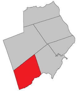 Location within Albert County. | |
| Coordinates: 45.64°N 65.00°W | |
| Country | |
| Province | |
| County | Albert County |
| Established | 1847 |
| Area | |
| • Land | 222.79 km2 (86.02 sq mi) |
| Population (2011)[1] | |
| • Total | 0 |
| • Density | 0.0/km2 (0/sq mi) |
| • Pop 2006-2011 | |
| • Dwellings | 7 |
| Time zone | UTC-4 (AST) |
| • Summer (DST) | UTC-3 (ADT) |
| Median Income* | $32,995 CDN |
| |
History
Alma Parish was set off from Harvey Parish in 1855: named for the heights above the Alma River in Crimea where the British forces won a major battle in 1855.
Delineation
Alma Parish is defined in the Territorial Division Act[2] as being bounded:
- North by the westerly prolongation of the northern boundary of Harvey Parish; west by the County line; south by Chignecto Bay, and east by Harvey Parish.
Communities
Parish population total does not include incorporated municipalities (in bold).
|
|
|
|
Demographics
Population
| Canada census – Alma Parish, New Brunswick community profile | |||
|---|---|---|---|
| 2011 | 2006 | ||
| Population: | 0 (-100.0% from 2006) | 5 (0.0% from 2001) | |
| Land area: | 222.79 km2 (86.02 sq mi) | 222.79 km2 (86.02 sq mi) | |
| Population density: | 0.0/km2 (0/sq mi) | 0.0/km2 (0/sq mi) | |
| Median age: | n/a (M: n/a, F: n/a) | n/a (M: n/a, F: n/a) | |
| Total private dwellings: | 7 | 6 | |
| Median household income: | $.N/A | $.N/A | |
| Notes: Income & median age data for this area has been suppressed for data quality or confidentiality reasons. – References: 2011[3] 2006[4] earlier[5] | |||
|
|
Access routes
Highways and numbered routes that run through the parish, including external routes that start or finish at the parish limits:[7]
gollark: Apparently Notelia is too!
gollark: Wow, that's very high employment.
gollark: According to this Anrak is in the bottom 7% of the world for income equality, bottom 1% for law enforcement, bottom 4% for health, but top 2% for rudeness, crime and recreational drug use.
gollark: You have to admit that this is quite impressive.
gollark: And this is my test nation.
See also
Notes
- Civil parishes served a variety of government functions until 1966, when the new Municipalities Act stripped them of their responsibilities; parishes continue to provide convenient boundaries for federal and provincial electoral districts. Statistics Canada uses civil parishes as census subdivisions for all parts of the province that are not within municipalities and similar entities.
References
- 2011 Statistics Canada Census Profile: Alma Parish, New Brunswick
- "Territorial Division Act (R.S.N.B. 1973, c. T-3)". Government of New Brunswick website. Retrieved 17 August 2016.
- "2011 Community Profiles". 2011 Canadian Census. Statistics Canada. July 5, 2013. Retrieved 2014-04-28.
- "2006 Community Profiles". 2006 Canadian Census. Statistics Canada. March 30, 2011. Retrieved 2014-04-28.
- "2001 Community Profiles". 2001 Canadian Census. Statistics Canada. February 17, 2012.
- Statistics Canada: 1996, 2001, 2006, 2011 census
- Atlantic Canada Back Road Atlas ISBN 978-1-55368-618-7
External links
Places adjacent to Alma Parish, New Brunswick | |
|---|---|
| Subdivisions |
|
|---|---|
| Cities | |
| Counties | |
| |
This article is issued from Wikipedia. The text is licensed under Creative Commons - Attribution - Sharealike. Additional terms may apply for the media files.