Great Whelnetham
Great Whelnetham (sometimes Great Welnetham[3]) is a village and civil parish in the St Edmundsbury district of Suffolk in eastern England. Located around two miles south of Bury St Edmunds, in 2005 its population was 820.[1]
| Great Whelnetham | |
|---|---|
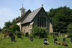
 Church of St Thomas à Becket | |
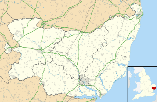
 Great Whelnetham Location within Suffolk | |
| Population | 820 (2005)[1] 849 (2011)[2] |
| District | |
| Shire county | |
| Region | |
| Country | England |
| Sovereign state | United Kingdom |
| Post town | Bury St Edmunds |
| Postcode district | IP30 |
| Police | Suffolk |
| Fire | Suffolk |
| Ambulance | East of England |
The parish also contains the hamlet of Cocks Green, and the village of Sicklesmere, with which Great Whelnetham is contiguous. Until the Beeching Axe, the area was served by Welnetham railway station on the Long Melford-Bury St Edmunds branch line.
Demography
According to the Office for National Statistics, at the time of the United Kingdom Census 2001, Great Whelnetham had a population of 830 with 349 households,[4] increasing to 849 in 348 households at the 2011 Census.
Population change
| Population growth in Great Whelnetham from 1801 to 1891 | |||||||||||
|---|---|---|---|---|---|---|---|---|---|---|---|
| Year | 1801 | 1811 | 1821 | 1831 | 1841 | 1851 | 1881 | 1891 | |||
| Population | 222 | 266 | 399 | 422 | 514 | 552 | 440 | 362 | |||
| Source: A Vision of Britain Through Time[5] | |||||||||||
| Population growth in Great Whelnetham from 1901 to 2001 | |||||||||||
|---|---|---|---|---|---|---|---|---|---|---|---|
| Year | 1901 | 1911 | 1921 | 1931 | 1951 | 1961 | 2001 | 2011 | |||
| Population | 357 | 366 | 359 | 315 | 442 | 444 | 830 | 849 | |||
| Source: A Vision of Britain Through Time[5] | |||||||||||
Location grid
gollark: Certain SQL schemae can be very fearsome.
gollark: Perhaps they intended to use the unused ones, but people filled the unused ones with PURE memetic beeite.
gollark: * addresses
gollark: The stack is just local variables and return values.
gollark: And parameter stuff.
References
- Estimates of Total Population of Areas in Suffolk Archived 2008-12-19 at the Wayback Machine Suffolk County Council
- "Civil Parish population 2011". Neighbourhood Statistics. Office for National Statistics. Retrieved 21 August 2016.
- Ordnance Survey: Explorer 211. Shows the civil parish as "Great Whelnetham" but the village as "Great Welnetham". Village signs all show "Great Whelnetham".
- "Suffolk County Council - 2001 Census Profiles" (PDF). Archived from the original (PDF) on 28 September 2011. Retrieved 22 February 2011.
- "A Vision of Britain Through Time". University of Portsmouth & others. Retrieved 22 February 2011.
This article is issued from Wikipedia. The text is licensed under Creative Commons - Attribution - Sharealike. Additional terms may apply for the media files.