Hawstead
Hawstead is a small village in Suffolk, England. It is located 5 kilometres (3 mi) south of Bury St. Edmunds between the B1066 and A134 roads, in a fork formed by the River Lark and a small tributary.
| Hawstead | |
|---|---|
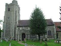
 All Saints' Church, Hawstead | |
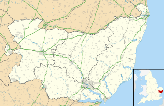
 Hawstead Location within Suffolk | |
| Population | 134 (2011 Census)[1] |
| District | |
| Shire county | |
| Region | |
| Country | England |
| Sovereign state | United Kingdom |
| Post town | Bury St Edmunds |
| Postcode district | IP29 |
The place-name 'Hawstead' is first attested in the Domesday Book of 1086, where it appears as Haldsteada. The name is thought to mean 'a place of shelter for cattle'.[2]
Hawstead Place, previously the seat of the Drury family, is now a farmhouse. Sir William Drury was sheriff and knight of the shire for Suffolk. Lt Col Edward Robert Drury, son of Rev Sir William Drury, was the first General Manager and President of the Queensland Bank of Australia now the National Australia Bank; he named his Queensland home 'Hawstead' in 1875.
Lady Drury's Closet (also known as the Hawstead Panels), now in Christchurch Mansion in Ipswich, is a series of painted wooden panels of early 17th-century date. They originally decorated a painted closet adjacent to a bedroom in Hawstead Place. It is believed they were made for Anne Drury, Lady Drury, wife of Sir Robert Drury, who died in 1624.
Demography
According to the Office for National Statistics, at the time of the United Kingdom Census 2001, Hawstead had a population of 334 with 121 households.[3] falling to a population of 134 in 56 households at the 2011 Census.
Population change
| Population growth in Hawstead from 1801 to 1891 | ||||||||||
|---|---|---|---|---|---|---|---|---|---|---|
| Year | 1801 | 1811 | 1821 | 1831 | 1841 | 1851 | 1881 | 1891 | ||
| Population | 392 | 409 | 404 | 414 | 457 | 520 | 321 | 325 | ||
| Source: A Vision of Britain Through Time[4] | ||||||||||
| Population growth in Hawstead from 1901 to 2001 | |||||||||||
|---|---|---|---|---|---|---|---|---|---|---|---|
| Year | 1901 | 1911 | 1921 | 1931 | 1951 | 1961 | 2001 | 2011 | |||
| Population | 297 | 292 | 266 | 228 | 256 | 248 | 334 | 134 | |||
| Source: A Vision of Britain Through Time[4] | |||||||||||
Location grid
References
- "Civil Parish population 2011". Neighbourhood Statistics. Office for National Statistics. Retrieved 22 August 2016.
- Eilert Ekwall, The Concise Oxford Dictionary of English Place-names, pp.227 and 213.
- "Suffolk County Council - 2001 Census Profiles" (PDF). Archived from the original (PDF) on 28 September 2011. Retrieved 22 February 2011.
- "A Vision of Britain Through Time". University of Portsmouth & others. Retrieved 22 February 2011.