Sicklesmere
Sicklesmere is a village in Suffolk, England. Located on the A134 around a mile south of Bury St Edmunds, the village is divided between the civil parishes of Little and Great Whelnetham .
| Sicklesmere | |
|---|---|
 Sicklesmere Location within Suffolk | |
| Shire county | |
| Region | |
| Country | England |
| Sovereign state | United Kingdom |
| Post town | Bury St Edmunds |
| Postcode district | IP30 |
History
All spellings of the name until the seventeenth century are with -d-, starting with Sidulfes mere circa 1100. The purported 1272 spelling Sykolvesmere, in W. Rye, A Calendar of the Feet of Fines for Suffolk (1900) is an error by Rye; the manuscript of the fine in the National Archives actually has Sydolvesm[er]e.[1] The village is named after a mere or lake that used to be present near the River Lark, and the first element is the Old English personal name *Siduwulf, not a Norse name (Keith Briggs and Kelly Kilpatrick, A dictionary of Suffolk place-names, Nottingham: EPNS & SIAH 2016, page 122). In truth it is no more than a small cluster of properties besides the River Lark. Many of these are flint-built cottages.
A circular shaped building known as the Toll House is located on the main road. In the days of coach travel there was a regular service between Norwich and London via Sudbury which ran four times a day through Sicklesmere. The village was also previously served by Welnetham railway station until the Beeching Axe.
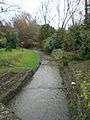
The village has a pub, the Rushbrooke Arms.[2]
Gallery
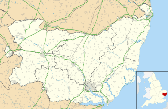
 River Lark at Sicklesmere
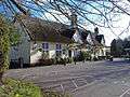 The Rushbrooke Arms
 Village Store
References
- "CP25(1)215/32/11". AALT.
- "Rushbrooke Arms".