Grant County Regional Airport
Grant County Regional Airport - GCRA (IATA: JDA, ICAO: KGCD, FAA LID: GCD, formerly 5J0) (Ogilvie Field) is in Grant County, Oregon, a mile southwest of John Day, Oregon.[1] The National Plan of Integrated Airport Systems for 2011–2015 categorized it as a general aviation facility.[2]
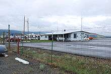
Grant County Regional Airport (GCRA) Ogilvie Field | |||||||||||||||
|---|---|---|---|---|---|---|---|---|---|---|---|---|---|---|---|
 June 2009 | |||||||||||||||
| Summary | |||||||||||||||
| Airport type | Public | ||||||||||||||
| Owner | Grant County | ||||||||||||||
| Serves | John Day, Oregon | ||||||||||||||
| Elevation AMSL | 3,703 ft / 1,129 m | ||||||||||||||
| Coordinates | 44°24′10″N 118°58′04″W | ||||||||||||||
| Runways | |||||||||||||||
| |||||||||||||||
| Statistics (2010) | |||||||||||||||
| |||||||||||||||
Most U.S. airports use the same three-letter location identifier for the FAA and IATA, but this airport is GCD to the FAA[1] and JDA to the IATA.[3][4]
Facilities
The airport covers 335 acres (136 ha) at an elevation of 3,703 feet (1,129 m). It has two asphalt runways: 17/35 is 5,220 by 60 feet (1,591 x 18 m) and 9/27 is 4,471 by 60 feet (1,363 x 18 m).[1]
In the year ending April 12, 2010 the airport had 9,500 aircraft operations, average 26 per day: 83% general aviation, 16% air taxi, and 1% military. 21 aircraft were then based at the airport: 86% single-engine and 14% ultralight.[1]
References
- FAA Airport Master Record for GCD (Form 5010 PDF). Federal Aviation Administration. Effective April 5, 2012.
- "Appendix A: List of NPIAS Airports with 5-Year Forecast Activity and Development Cost" (PDF). National Plan of Integrated Airport Systems (2011-2015). Federal Aviation Administration. October 4, 2010. Archived from the original (PDF) on September 27, 2012. Retrieved April 1, 2018.
- "Grant County Regional Airport (IATA: JDA, ICAO: KGCD, FAA: GCD)". Great Circle Mapper. Retrieved June 15, 2012.
- "John Day Airport, OR (IATA: JDA)". Aviation Safety Network. Retrieved June 15, 2012.
External links
- Grant County Regional Airport
- Grant County Services
- Aerial image from USGS The National Map
- FAA Terminal Procedures for GCD, effective July 16, 2020
- Resources for this airport:
- FAA airport information for GCD
- AirNav airport information for KGCD
- ASN accident history for JDA
- FlightAware airport information and live flight tracker
- NOAA/NWS weather observations: current, past three days
- SkyVector aeronautical chart, Terminal Procedures