Christmas Valley Airport
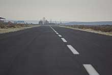
Christmas Valley Airport (FAA LID: 62S) located 1 m (2 km) southeast of Christmas Valley, Oregon. The airport consists of a 60' (18m) wide runway with a segmented circle marked by white tires and a medium-intensity runway lighting system which allows 25 minutes for landing once an aircraft is on beam and activates the system. Pilot activates the Runway Edge Lights: RY 7/25 - Common Traffic Advisory Frequency (CTAF). Tie-downs are available but at this time there are no fuel or oxygen services onsite. Two single engine aircraft are based on the field. The airstrip is unattended and open for public use.
Christmas Valley Airport | |||||||||||
|---|---|---|---|---|---|---|---|---|---|---|---|
 | |||||||||||
| Summary | |||||||||||
| Airport type | Public | ||||||||||
| Operator | Christmas Valley Parks & Recreation | ||||||||||
| Location | Christmas Valley, Oregon | ||||||||||
| Elevation AMSL | 4,317 ft / 1,316 m | ||||||||||
| Coordinates | 43°14′12″N 120°39′58″W | ||||||||||
| Runways | |||||||||||
| |||||||||||
History
Established in 1962, the airport was intended to promote land development.[1] The runway was built as part of the original development of the town and dedicated in 1985. A recent $500,000 grant from the Federal Aviation Administration widened, paved, and lit the mile-long airstrip.
References
External links
- Resources for this airport:
- FAA airport information for 62S
- AirNav airport information for 62S
- FlightAware airport information and live flight tracker
- SkyVector aeronautical chart for 62S
- Airport Layout Plan