Graizelound
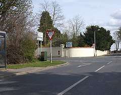
Graizelound is a hamlet in the civil parish of Haxey in North Lincolnshire, England. It is approximately 22 miles (35 km) to the north-west from the city and county town of Lincoln, and centred on the crossroad junction of Haxey Lane, Station Road, Akeferry Road and Ferry Road. The village of Haxey is less than 1 mile (1.6 km) to the north. Owston Ferry on the River Trent is 2.5 miles (4.0 km) to the north-east. Graizelound forms part of the Isle of Axholme.
| Graizelound | |
|---|---|
 Crossroads at the centre of Graizelound | |
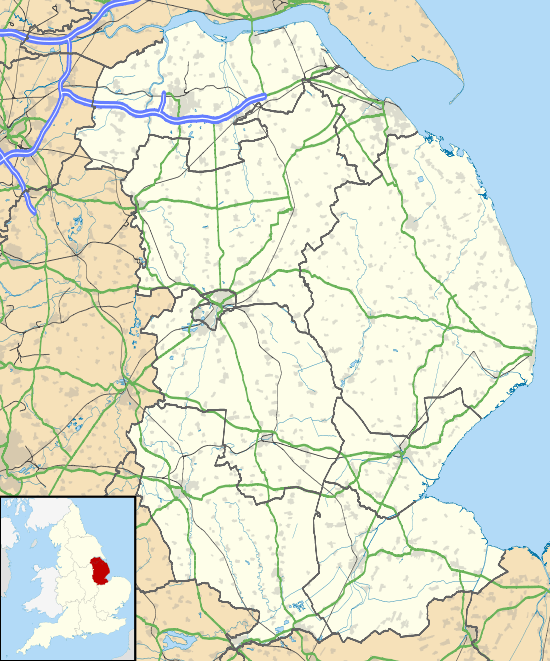
 Graizelound Location within Lincolnshire | |
| OS grid reference | SK771987 |
| • London | 130 mi (210 km) S |
| Unitary authority | |
| Ceremonial county | |
| Region | |
| Country | England |
| Sovereign state | United Kingdom |
| Post town | DONCASTER |
| Postcode district | DN9 |
| Dialling code | 01427 |
| Police | Humberside |
| Fire | Humberside |
| Ambulance | East Midlands |
According to A Dictionary of British Place Names, the 'lound' in Graizelound derives from the Old Scandinavian 'lundr' for "a small wood or grove".[1] Graizelound is recorded in the 1086 Domesday Book as "Lund", being a name for both the later East Lound and Graizelound, in the hundred of Epworth and the West Riding of Lindsey. The settlement contained ten households, four villagers, four freemen, two tributaries, 0.6 ploughlands, 3.5 men's plough teams, and a fishery. The lords of the manor in 1066 were Alnoth and Ulf Fenman. Following Domesday, lordship was given to Geoffrey de La Guerche who was also Tenant-in-chief to King William I.[2][3][4]

Graizelound is recorded in the 1872 White's Directory as a hamlet of Haxey parish with a list of occupations and residents that included thirty farmers, two of whom were also shopkeepers, a joiner & wheelwright, a blacksmith, a shoemaker, and an occupant of a day school. At Cumberworth Lodge lived Thomas Wharton Emerson, and at Sobraon Lodge, Captain William Henry Emerson,[5] who were brothers, and nephews to Sir Wharton Amcotts, 1st Baronet of Kettlethorpe Hall.[6]
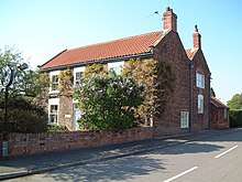
Cumberworth Lodge on Ferry Road (Main Street), is today a care home,[7] and is a Grade II listed rendered brick building that dates to the mid-18th-century.[8] Further Grade II listed buildings are the 18th-century red brick Lound House on Main Street,[9] and on Graizelound Fields Roads, Manor House, of brown brick built in 1791,[10] and the early 19th-century red brick Croft House.[11]
References
- Mills, Anthony David (2003); A Dictionary of British Place Names, Oxford University Press, revised edition (2011), p.307. ISBN 019960908X
- "Documents Online: Graizelound, Lincolnshire", Great Domesday Book, Folio: 369r. The National Archives. Retrieved 9 January 2019
- "(East) Lound and (Graise) Lound", Opendomesday. Retrieved 9 January 2019
- Stonehouse, William Brocklehurst; (1849) The History and Topography of the Isle of Axholme: Being That Part of Lincolnshire Which Is West of Trent, Reprint Nabu Press (2010), p.310. ISBN 1148102175
- White, William (1872), Whites Directory of Lincolnshire, pp.456-459
- Burke, John; Burke,Bernard; "Emerson, of Lincolnshire", Heraldic Illustrations: Comprising the Armorial Bearings of the Principal Families of the Empire, Volume 3 (1846). Retrieved 9 January 2019
- " Cumberworth Lodge Care Home", Care Quality Commission. Retrieved 9 January 2019
- Historic England. "Cumberworth Lodge and Screen Wall Adjoining to North (1067765)". National Heritage List for England. Retrieved 9 January 2019.
- Historic England. "Lound House (1083256)". National Heritage List for England. Retrieved 9 January 2019.
- Historic England. "Manor House (1346689)". National Heritage List for England. Retrieved 9 January 2019.
- Historic England. "Croft House (1083253)". National Heritage List for England. Retrieved 9 January 2019.
External links

- "Haxey", includes Graizelound. The Isle of Axholme Family History Society. Retrieved 9 January 2019
- "Haxey", Isleofaxholme.co.uk, includes Graizelound. Retrieved 9 January 2019