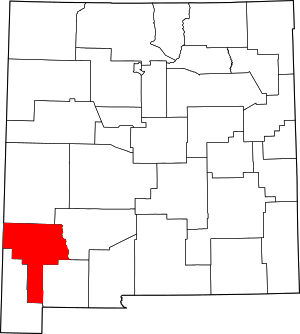
Gila, New Mexico
Gila is a census-designated place in Grant County, New Mexico, United States. It is 30 miles northwest of Silver City, New Mexico. Its population was 314 as of the 2010 census.[2]
Gila, New Mexico | |
|---|---|
 Gila  Gila | |
| Coordinates: 32°57′58″N 108°34′37″W | |
| Country | United States |
| State | New Mexico |
| County | Grant |
| Area | |
| • Total | 9.394 sq mi (24.33 km2) |
| • Land | 9.362 sq mi (24.25 km2) |
| • Water | 0.032 sq mi (0.08 km2) |
| Elevation | 4,557 ft (1,389 m) |
| Population (2010) | |
| • Total | 314 |
| • Density | 33/sq mi (13/km2) |
| Time zone | UTC-7 (MST) |
| • Summer (DST) | UTC-6 (MDT) |
| ZIP code | 88038 |
| Area code(s) | 575 |
| FIPS code | 35-17-29160 |
| GNIS feature ID | 898782 |
History
Gila and the nearby town of Cliff were settled in 1884. The area was and is primarily a ranching and farming community. The local Gila Post Office was established on April 5, 1875.
Economics and culture
Services in Gila include: post office, library, EMT and medical clinic, community center, senior center, library, and several churches. The library collection contains 3025 volumes. The library circulates 1539 items per year.[3]
Transportation
Major highways
Gila can be accessed via NM 211 from US 180 north of Silver City. Also, NM 153 provides access to Turkey Creek.
References in popular culture
- Gila is the town where Michael Scofield has Sara Tancredi meet him on the television series Prison Break.
gollark: Defaults are the tyranny of the majority.
gollark: CC's amount of global state is very annoying.
gollark: Code not working is the default state of it. To make it work is much harder than to make it not work.
gollark: Actually, maybe not, I'm not quite sure... oh well.
gollark: It has to be poorly written code which also does fancy stuff.
References
- "US Gazetteer files: 2010, 2000, and 1990". United States Census Bureau. 2011-02-12. Retrieved 2011-04-23.
- "U.S. Census website". United States Census Bureau. Retrieved 2011-05-14.
- http://www.librarytechnology.org/lwc-displaylibrary.pl?RC=37795, retrieved on 17 December 2008.
This article is issued from Wikipedia. The text is licensed under Creative Commons - Attribution - Sharealike. Additional terms may apply for the media files.
