Franklin Commonwealth Marine Reserve
Franklin Commonwealth Marine Reserve is a 671 km2 marine protected area within Australian waters located off the west coast of north-west Tasmania. The reserve was established in 2007[2] and is part of the South-east Commonwealth Marine Reserve Network.
| Franklin Commonwealth Marine Reserve | |
|---|---|
IUCN category VI (protected area with sustainable use of natural resources) | |
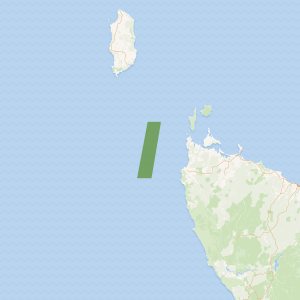
Map showing the Franklin Commonwealth Marine Reserve | |
| Location | Indian Ocean, Australia |
| Nearest town | Marrawah, Tasmania |
| Coordinates | 40.76°S 144.28°E[1] |
| Area | 671 km2 (259 sq mi) |
| Established | August 31, 2007 |
| Governing body | Parks Australia (Commonwealth of Australia) |
| environment | |
The area incorporates two major bioregions: western Bass Strait and the Tasmanian shelf. To the north of the reserve is Black Pyramid Rock, which supports the largest breeding colony of the Australasian gannet in Tasmania.[3]
Protection
The entirety of the Franklin marine reserve area is IUCN protected area category VI and zoned as 'Multiple Use'.[3]
| Zone | IUCN | Activities permitted | Area (km2) | |||||||||||||||||||||||||||||||||||||||||||||||||||||||||||||||||||||||||||||||||||||||||||||||
|---|---|---|---|---|---|---|---|---|---|---|---|---|---|---|---|---|---|---|---|---|---|---|---|---|---|---|---|---|---|---|---|---|---|---|---|---|---|---|---|---|---|---|---|---|---|---|---|---|---|---|---|---|---|---|---|---|---|---|---|---|---|---|---|---|---|---|---|---|---|---|---|---|---|---|---|---|---|---|---|---|---|---|---|---|---|---|---|---|---|---|---|---|---|---|---|---|---|---|
| Recreational fishing | Commercial fishing | Mining | ||||||||||||||||||||||||||||||||||||||||||||||||||||||||||||||||||||||||||||||||||||||||||||||||
| Multiple Use | VI | Yes | with approval | with approval | 671 | |||||||||||||||||||||||||||||||||||||||||||||||||||||||||||||||||||||||||||||||||||||||||||||
| [Note 1] | ||||||||||||||||||||||||||||||||||||||||||||||||||||||||||||||||||||||||||||||||||||||||||||||||||
gollark: > Tell me why exactly you think someone would go to the effort of grafting and setting up a real company, only to con people... because, conning people... gets you money?
gollark: burden of proof™
gollark: Nuclear is very cool and needs to be used more.
gollark: As far as I know it's something like ~~0.5% efficiency~~ (correction: wikipedia says ~5%) and the main advantage of photosynthesis is just that it produces convenient storable chemical energy as output.
gollark: I have a fun diagram too!
See also
- Commonwealth marine reserves
- Protected areas of Australia
- Great Australian Bight
Notes
- Summary of permitted activities only, see source for details[4]
References
- "Franklin Commonwealth Marine Reserve on OpenStreetMap". openstreetmap.org. © OpenStreetMap contributors. Retrieved 17 June 2017.
- "Collaborative Australian Protected Areas Database (CAPAD) 2014 - Marine". environment.gov.au. © Commonwealth of Australia. Retrieved 17 June 2017.
- "Franklin Commonwealth Marine Reserve". environment.gov.au. © Commonwealth of Australia. Retrieved 17 June 2017.
- "South-east Commonwealth Marine Reserves Network - Zoning and activities". environment.gov.au. © Commonwealth of Australia. Retrieved 16 June 2017.
External links
This article is issued from Wikipedia. The text is licensed under Creative Commons - Attribution - Sharealike. Additional terms may apply for the media files.