Federalsburg, Maryland
Federalsburg is a town in Caroline County, Maryland, United States. The population was 2,739 at the 2010 United States Census. It has one high school, Colonel Richardson High School.
Federalsburg, Maryland | |
|---|---|
Town | |
| Town of Federalsburg | |
| Motto(s): "Pride in the Past, Faith in the Future"[1] | |
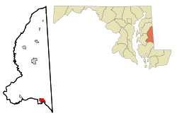
 Location of Federalsburg, Maryland | |
 Federalsburg Location within the U.S. state of Maryland  Federalsburg Federalsburg (the United States) | |
| Coordinates: 38°41′28″N 75°46′24″W | |
| Country | |
| State | |
| County | |
| Incorporated | 1823[2] |
| Government | |
| • Mayor | Kimberly M. Jahnigen[3] |
| Area | |
| • Total | 1.99 sq mi (5.15 km2) |
| • Land | 1.93 sq mi (5.00 km2) |
| • Water | 0.06 sq mi (0.15 km2) |
| Elevation | 3 ft (1 m) |
| Population | |
| • Total | 2,739 |
| • Estimate (2019)[6] | 2,661 |
| • Density | 1,378.76/sq mi (532.32/km2) |
| Time zone | UTC−5 (Eastern (EST)) |
| • Summer (DST) | UTC−4 (EDT) |
| ZIP code | 21632 |
| Area code | 410 |
| FIPS code | 24-27900 |
| GNIS feature ID | 0593884 |
| Website | www.Federalsburg.org |
History
The town was named for the Federalist Party that met there in 1812,[7] and was incorporated in 1823.[2] Another source maintains Federalsburg was so named because it was settled by people from northern states.[8]
Geography
Federalsburg is located at 38°41′28″N 75°46′24″W (38.691126, -75.773296).[9]
According to the United States Census Bureau, the town has a total area of 2.02 square miles (5.23 km2), of which 1.93 square miles (5.00 km2) is land and 0.09 square miles (0.23 km2) is water.[10]
Demographics
| Historical population | |||
|---|---|---|---|
| Census | Pop. | %± | |
| 1880 | 338 | — | |
| 1890 | 543 | 60.7% | |
| 1900 | 539 | −0.7% | |
| 1910 | 1,050 | 94.8% | |
| 1920 | 1,288 | 22.7% | |
| 1930 | 1,369 | 6.3% | |
| 1940 | 1,748 | 27.7% | |
| 1950 | 1,878 | 7.4% | |
| 1960 | 2,060 | 9.7% | |
| 1970 | 1,917 | −6.9% | |
| 1980 | 1,952 | 1.8% | |
| 1990 | 2,365 | 21.2% | |
| 2000 | 2,620 | 10.8% | |
| 2010 | 2,739 | 4.5% | |
| Est. 2019 | 2,661 | [6] | −2.8% |
| U.S. Decennial Census[11] | |||
2010 census
As of the census[5] of 2010, there were 2,739 people, 1,081 households, and 708 families living in the town. The population density was 1,419.2 inhabitants per square mile (548.0/km2). There were 1,191 housing units at an average density of 617.1 per square mile (238.3/km2). The racial makeup of the town was 53.8% White, 41.0% African American, 0.3% Native American, 0.8% Asian, 1.3% from other races, and 2.8% from two or more races. Hispanic or Latino of any race were 3.6% of the population.
There were 1,081 households of which 41.0% had children under the age of 18 living with them, 31.8% were married couples living together, 26.9% had a female householder with no husband present, 6.8% had a male householder with no wife present, and 34.5% were non-families. 29.3% of all households were made up of individuals and 11.5% had someone living alone who was 65 years of age or older. The average household size was 2.53 and the average family size was 3.10.
The median age in the town was 33.3 years. 30.8% of residents were under the age of 18; 9.5% were between the ages of 18 and 24; 24.3% were from 25 to 44; 23.1% were from 45 to 64; and 12.5% were 65 years of age or older. The gender makeup of the town was 45.2% male and 54.8% female.
2000 census
As of the census[12] of 2000, there were 2,620 people, 1,045 households, and 714 families living in the town. The population density was 1,341.5 people per square mile (518.8/km2). There were 1,130 housing units at an average density of 578.6 per square mile (223.7/km2). The racial makeup of the town was 58.93% White, 36.83% African Americans, 0.31% Native American, 0.65% Asian, 0.04% Pacific Islander, 0.38% from other races, and 2.86% from two or more races. Hispanic or Latino of any race were 1.11% of the population.
There were 1,045 households out of which 37.1% had children under the age of 18 living with them, 38.4% were married couples living together, 25.0% had a female householder with no husband present, and 31.6% were non-families. 27.3% of all households were made up of individuals and 13.8% had someone living alone who was 65 years of age or older. The average household size was 2.51 and the average family size was 2.97.
In the town, the age distribution of the population shows 30.8% under the age of 18, 9.7% from 18 to 24, 26.0% from 25 to 44, 19.4% from 45 to 64, and 14.2% who were 65 years of age or older. The median age was 33 years. For every 100 females, there were 81.8 males. For every 100 females age 18 and over, there were 74.9 males.
The median income for a household in the town was $24,266, and the median income for a family was $32,059. Males had a median income of $28,438 versus $21,296 for females. The per capita income for the town was $13,878. About 21.0% of families and 25.3% of the population were below the poverty line, including 35.2% of those under age 18 and 18.2% of those age 65 or over.
Arts and culture
Exeter was listed on the National Register of Historic Places in 1978.[13]

The town hosted the 58th Annual Delmarva Chicken Festival in 2007 at Marshy Hope Marina Park, the second time it has done so.
Sports
Federalsburg was host to three Eastern Shore Baseball League minor league teams – the Athletics, Little A's, and Feds.
Government
Town officials and staff
- Mayor: Kimberly Jahnigen Abner
- Council President: Scott Phillips
- Council Members: David Morean, Debra Varady Sewell, Edward H. Windsor
- Chief of Police: Michael A. McDermott
- Town Manager: Lawrence DiRe
- Clerk-Treasurer: Kristy L. Marshall
- Deputy Clerk: Melissa D. Hrobar
- Accounting Clerk: Kimberly M. Brown
- Main Street Manager/Grants Administrator: vacant
- Code Enforcement Officer: John Garlick
- Public Works Director: Steve Dyott
Media
Federalsburg is the home of the radio station WTDK also known as THE DUCK.
Notable person
- Robert "Ducky" Detweiler, former professional baseball player with the Boston Braves from 1942–1946.
References
- "Town of Federalsburg, Maryland". Town of Federalsburg, Maryland. Retrieved August 25, 2012.
- "Federalsburg, Maryland". City-Data.com. Retrieved August 24, 2012.
- "Mayor and Council - www.federalsburg.org". federalsburg.org. Retrieved January 11, 2020.
- "2019 U.S. Gazetteer Files". United States Census Bureau. Retrieved July 25, 2020.
- "U.S. Census website". United States Census Bureau. Retrieved 2013-01-25.
- "Population and Housing Unit Estimates". United States Census Bureau. May 24, 2020. Retrieved May 27, 2020.
- "Profile for Federalsburg, Maryland, MD". ePodunk. Retrieved August 24, 2012.
- Gannett, Henry (1905). The Origin of Certain Place Names in the United States. Govt. Print. Off. pp. 125.
- "US Gazetteer files: 2010, 2000, and 1990". United States Census Bureau. 2011-02-12. Retrieved 2011-04-23.
- "US Gazetteer files 2010". United States Census Bureau. Archived from the original on January 12, 2012. Retrieved 2013-01-25.
- "Census of Population and Housing". Census.gov. Retrieved June 4, 2015.
- "U.S. Census website". United States Census Bureau. Retrieved 2008-01-31.
- "National Register Information System". National Register of Historic Places. National Park Service. April 15, 2008.
