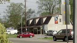
Bethlehem, Maryland
Bethlehem is a populated place in Caroline County, Maryland, United States.[1] Bethlehem is located at the intersection of Maryland routes 331 and 578, northwest of Preston.
Bethlehem, Maryland | |
|---|---|
Populated place | |
 Bethlehem, Maryland | |
 Bethlehem | |
| Coordinates: 38°44′46″N 75°56′39″W | |
| Country | United States |
| State | Maryland |
| County | Caroline |
| Elevation | 46 ft (14 m) |
| Time zone | UTC−5 (Eastern (EST)) |
| • Summer (DST) | UTC−4 (EDT) |
| ZIP code | 21609 |
| Area code(s) | 410, 443, and 667 |
| GNIS feature ID | 583190[1] |
History
Bethlehem dates far back as 1875, when a U.S Post Office was established as Bethlehem P.O.[2][3] According to the USGS, the post office was established in 1857.[4]
Notable person
William Oswald Mills (August 12, 1924 – May 24, 1973), aka Bill Mills, was a Republican U.S. congressman who represented the 1st Congressional district of Maryland from May 25, 1971 until his death. Mills was born in Bethlehem.
gollark: `mat[m]`
gollark: No, you s hould be fine.
gollark: Please make sure to open the full resolution version for the maximum the noncognitohazardous effect.
gollark: https://media.discordapp.net/attachments/461970193728667648/855836953407389726/out.png
gollark: Look at this NON-COGNITOHAZARD, and reconsider!
References
- "Bethlehem". Geographic Names Information System. United States Geological Survey.
- Map of Caroline County, Maryland as entered according to act of Congress in the year 1875 by John B. Isler in the Office of the Librarian of Congress at Washington DC.
- Isler, John B (1875). "Map of Caroline County Maryland" (Map). Map of Caroline County, Maryland. 1:42,000. Caroline County.
- "Bethlehem Post Office". Geographic Names Information System. United States Geological Survey.
This article is issued from Wikipedia. The text is licensed under Creative Commons - Attribution - Sharealike. Additional terms may apply for the media files.
