Ervin Township, Howard County, Indiana
Ervin Township is one of eleven townships in Howard County, Indiana, United States. As of the 2010 census, its population was 2,227 and it contained 879 housing units.[2]
Ervin Township | |
|---|---|
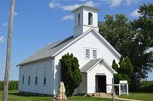
 Former Poplar Grove Methodist Church | |
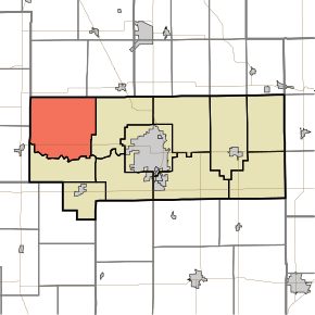
 Location in Howard County | |
| Coordinates: 40°31′20″N 86°18′33″W | |
| Country | United States |
| State | Indiana |
| County | Howard |
| Government | |
| • Type | Indiana township |
| Area | |
| • Total | 42.24 sq mi (109.4 km2) |
| • Land | 42.24 sq mi (109.4 km2) |
| • Water | 0 sq mi (0 km2) 0% |
| Elevation | 791 ft (241 m) |
| Population (2010) | |
| • Total | 2,227 |
| • Estimate (2012[1]) | 2,234 |
| • Density | 52.7/sq mi (20.3/km2) |
| GNIS feature ID | 0453279 |
History
Ervin township was named for Robert Ervin, a county judge.[3]
In the mid-1800s, the township was home to two African American settlements, the Rush Settlement and the Bassett Settlement.[4] The Bassett settlement was the home of Richard Bassett, a Baptist minister who later became the third African-American state representative in Indiana history, and the first from Howard County.[4]
Geography
| Historical population | |||
|---|---|---|---|
| Census | Pop. | %± | |
| 2000 | 2,331 | — | |
| 2010 | 2,227 | −4.5% | |
| Est. 2012 | 2,234 | 0.3% | |
| U.S. Census[5] | |||
According to the 2010 census, the township has a total area of 42.24 square miles (109.4 km2), all land.[2] The stream of Petes Run runs through this township.
Unincorporated towns
- Judson
- Kappa Corner
- Poplar Grove
- Ridgeway
(This list is based on USGS data and may include former settlements.)
Adjacent townships
- Deer Creek Township, Cass County (north)
- Jackson Township, Cass County (northeast)
- Clay Township (east)
- Monroe Township (south)
- Burlington Township, Carroll County (west)
- Carrollton Township, Carroll County (west)
Cemeteries
The township contains ten cemeteries: Barnett, Brown, Kappa, Mound, North Union, Petes Run, Pickett, Price, Rush and South Union.
Major highways
References
- "Ervin Township, Howard County, Indiana". Geographic Names Information System. United States Geological Survey. Retrieved 2009-09-24.
- United States Census Bureau cartographic boundary files
- "Population Estimates". United States Census Bureau. Archived from the original on 2013-06-17. Retrieved 2013-06-25.
- "Population, Housing Units, Area, and Density: 2010 - County -- County Subdivision and Place -- 2010 Census Summary File 1". United States Census. Archived from the original on 2020-02-12. Retrieved 2013-05-10.
- "Howard County's Townships and Their Early Settlements and Towns". Kokomo-Howard County Public Library. Archived from the original on 22 December 2013. Retrieved 2 June 2014.
- Lishawna Taylor (July 30, 2014). "Howard County". Indiana Historical Society. Archived from the original on December 31, 2017. Retrieved 2017-12-10.
- "US Census Data". US Government Census Agency. Archived from the original on 8 October 2014. Retrieved 26 February 2014.
- "Early Settlements". Kokomo Library Genealogy Department. Archived from the original on 22 December 2013. Retrieved 22 December 2013.