Oakford, Indiana
Oakford (originally called Fairfield[3]) is an unincorporated community in southwestern Taylor Township, Howard County, Indiana, United States.
Oakford, Indiana | |
|---|---|
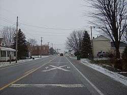 Approaching the railroad crossing in Oakford | |
 Oakford  Oakford | |
| Coordinates: 40°25′09″N 86°06′15″W | |
| Country | United States |
| State | Indiana |
| County | Howard |
| Township | Taylor |
| Elevation | 860 ft (260 m) |
| Time zone | Eastern Time Zone |
| ZIP code | 46902 |
| FIPS code | 18-55584[1] |
| GNIS feature ID | 440462[2] |
Oakford is part of the Kokomo, Indiana Metropolitan Statistical Area.
History
Oakford was laid out in 1852.[4] It was originally called Fairfield, and the name Oakford was adopted in 1854.[5]
Geography
Oakford lies at a railroad crossing of State Road 26, and little more than 1 mile (about 2 km) east of State Road 26's intersection with U.S. Route 31 until November 2013.[6] Now US 31 has been moved over, and Oakford is right at the State Road 26 exit (on the west side) on the new interstate grade Highway US 31.
It is located at 40°25′9″N 86°6′16″W.
gollark: Oh, it's just an optimization thing.
gollark: What's with the weird hashes in that, er, tuple?
gollark: Global variables... but functional.
gollark: Didn't this happen to Notch too? Veering off into weird political views a while after making a successful thingy?
gollark: I've always said she was insane, since I read the Cursed Child plot summary.
References
- "US Census website". United States Census Bureau. Retrieved 31 January 2008.
- "Oakford, Indiana". Geographic Names Information System. United States Geological Survey. Retrieved 2009-10-17.
- Geographic Names Information System Feature Detail Report, Geographic Names Information System, 14 February 1979. Accessed 7 January 2008.
- "Howard County's Townships and Their Early Settlements and Towns". Kokomo-Howard County Public Library. Archived from the original on 22 December 2013. Retrieved 2 June 2014.
- "A Look Back as We Move Forward". The Kokomo Tribune. 28 March 1999. p. 58. Retrieved 16 August 2014 – via Newspapers.com.

- DeLorme. Indiana Atlas & Gazetteer. 3rd ed. Yarmouth: DeLorme, 2004, p. 33. ISBN 0-89933-319-2.
Municipalities and communities of Howard County, Indiana, United States | ||
|---|---|---|
| City | Map of Indiana highlighting Howard County | |
| Towns | ||
| Townships | ||
| Other unincorporated communities | ||
This article is issued from Wikipedia. The text is licensed under Creative Commons - Attribution - Sharealike. Additional terms may apply for the media files.