Dunton, Buckinghamshire
Dunton is a village and civil parish in the Aylesbury Vale district of Buckinghamshire, England. The village is situated approximately 8 miles (13 km) north from Aylesbury and 4 miles (6.4 km) south-east from Winslow.
| Dunton | |
|---|---|
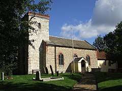 St Martin's Church | |
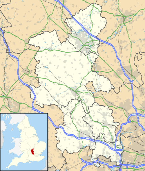 Dunton Location within Buckinghamshire | |
| Population | 189 (2011 Census including Hoggeston)[1] |
| OS grid reference | SP822241 |
| • London | 40 mi (64 km) SE |
| Unitary authority | |
| Ceremonial county | |
| Region | |
| Country | England |
| Sovereign state | United Kingdom |
| Post town | BUCKINGHAM |
| Postcode district | MK18 |
| Dialling code | 01525 |
| Police | Thames Valley |
| Fire | Buckinghamshire |
| Ambulance | South Central |
| UK Parliament | |
In 2011, Dunton had a population (including Hoggeston) of 189.[1] The parish contains a Grade II* listed church.
History
According to A Dictionary of British Place Names, the Dunton name is Old English in origin, and means an estate linked to a man called 'Dodda' or 'Dudda'. In the 1086 Domesday Book Dunton it is recorded as "Dodintone."[2]
In the 1870s, John Marius Wilson described Dunton as: "a parish in Winslow district, Bucks; near the source of the river Thame, 4 miles SE by S of Winslow town and r. station."[3]
Dunton's parish church is dedicated to St Martin. The church nave dates to the 12th century, the chancel to the 13th, and the tower to the 15th. Rebuilding and restoration took place in the 18th century. St Martin's was Grade II* listed by English Heritage in 1959.[4][5] The church is the only public building in Dunton, and is a centre for parish social life.[6] Further parish Grade II listed buildings include The Old Rectory, an early 18th-century house; and Dunton Manor, a 16th-century house with later alterations.[7][8]
Demographics
Dunton's population in 2011 was 189 according to census data.[1] Historically the parish population has not been this large. Past parish data shows population has only surpassed 100 people twice before 2001: once in 1831, when there were 116 people; and ten years later in 1841, when there were 107.[9]
The numbers of males and females follow a general trend between 1801 and 2011. The only year in which males and females were of equal number was 1961, when each numbered 38.[9]
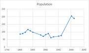 Total Dunton civil parish population levels taken from 1801 to 2011 census data
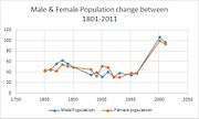 Numbers of males and females between 1801 and 2011 taken from census data
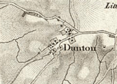 19th-century map of Dunton
References
- "Dunton: Key figures for 2011 Census: Key Statistics". Neighbourhood Statistics. Office for National Statistics. Retrieved 21 January 2015.
- Mills, Anthony David (2003); A Dictionary of British Place Names, Oxford University Press, revised edition (2011), p. 166. ISBN 019960908X
- Wilson, John Marius (1870–72). Imperial Gazetteer of England and Wales. Edinburgh: A.Fullerton & Co. Retrieved 27 January 2015.
- Historic England. "Church of St Martin (1211972)". National Heritage List for England. Retrieved 7 February 2015.
- Page, William. "Parishes: Dunton". British History Online. Victoria County History. Retrieved 31 January 2015.
- "St Martin's Church Dunton". Diocese of Oxford. Retrieved 6 February 2015.
- Historic England. "The Old Rectory, Main Road (1211976)". National Heritage List for England. Retrieved 7 February 2015.
- Historic England. "Dunton Manor, Hoggeston Road (1211969)". National Heritage List for England. Retrieved 7 February 2015.
- "Dunton CP/AP through time: Population Statistics: Total Population". A Vision of Britain through Time. GB Historical GIS / University of Portsmouth. Retrieved 5 February 2015.
External links