Districts of the Independent State of Croatia
Districts (Croatian: kotar) were the secondary territorial subdivisions of the Independent State of Croatia. There were 139 of them originally, with that number changing after the capitulation of Italy and the discontinuation of the Rome Agreement. The districts were each a part of a county, and were themselves further divided into municipalities.
Districts in 1941
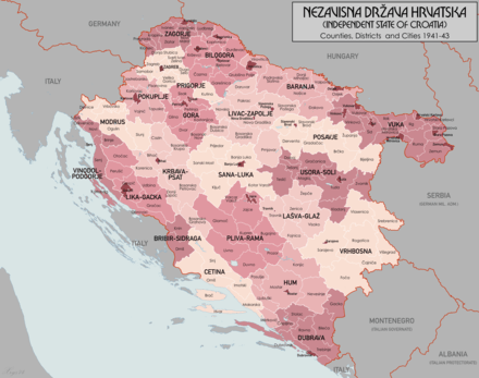
Districts of the Independent State of Croatia in 1941
Districts in 1943
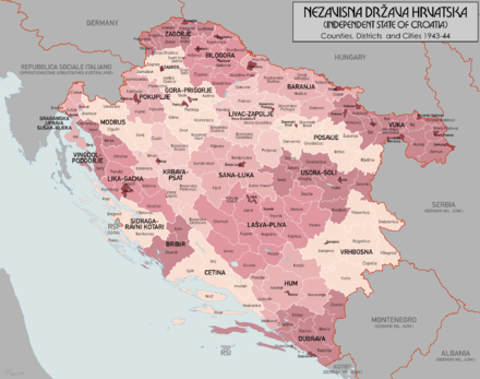
Districts of the Independent State of Croatia in 1943
gollark: Available for JS and... x86, somehow?
gollark: Calculators are a solved problem because RPNCalc4 was released a while ago.
gollark: If there's no internet connection, just procedurally generate responses to your HTTP requests.
gollark: Which... I guess you could make it autogenerate data if it doesn't find any!
gollark: "Known error" kind of also includes stuff like "record not found".
References
- Croatia OR 5360 (1:1 000 000) London : War Office, 1941
- Kraljevina Jugoslavija MDR Misc 7596 (1:2 800 000), Great Britain. Army. Royal Engineers. Map Reproduction Section, 1944
- Volkstumskarte von Jugoslawien (1:200 000) Wilfried Krallert, Wien, (1941)
- Encyclopædia Britannica 17th Edition, Austria-Hungary (1:3 800 000), 1905
- Crna Legija website
This article is issued from Wikipedia. The text is licensed under Creative Commons - Attribution - Sharealike. Additional terms may apply for the media files.