Coveñas Airport
Coveñas Airport (IATA: CVE, ICAO: SKCV) is a military airport serving the Caribbean coast town of Coveñas in the Sucre Department of Colombia. The runway is adjacent to the shore, and north departures and arrivals are over the Gulf of Morrosquillo.
Coveñas Airport | |||||||||||
|---|---|---|---|---|---|---|---|---|---|---|---|
| Summary | |||||||||||
| Airport type | Military | ||||||||||
| Serves | Coveñas, Colombia | ||||||||||
| Elevation AMSL | 31 ft / 9 m | ||||||||||
| Coordinates | 9°24′03″N 75°41′30″W | ||||||||||
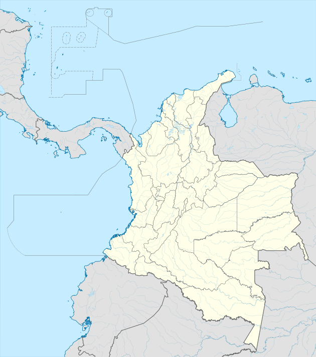
| Map | |||||||||||
 CVE Location of the airport in Colombia | |||||||||||
| Runways | |||||||||||
| |||||||||||
Airlines and destinations
| Airline | Destination |
|---|---|
| SARPA | Seasonal charter: Medellin-Olaya Herrera |
gollark: Lisp is not over because THERE IS NO MACRON.
gollark: ?tag lyricly projects
gollark: Thus, 🦀:crab:🦀.
gollark: The second (or third, I forgot in the 20 seconds since reading the list) biggest room appears to be for Rust.
gollark: Well, there are at least three separate ones for psychedelic drugs, what sound like NSFW ones, "conspiracy", Russian meshnet cryptolibertarians, some people working on adding more vegan locations to openstreetmap, bizarrely large amounts of activity from Perth, London biohackspace, "femboys", "science", and a weirdly popular bodyweight fitness one.
See also


- Transport in Colombia
- List of airports in Colombia
References
- Airport information for CVE at Great Circle Mapper.
- Google Maps - Coveñas
External links
- OpenStreetMap - Coveñas
- OurAirports - Coveñas
- SkyVector - Coveñas
- FallingRain - Coveñas Airport
- Airport information for SKCV at World Aero Data. Data current as of October 2006.
- Accident history for CVE at Aviation Safety Network
This article is issued from Wikipedia. The text is licensed under Creative Commons - Attribution - Sharealike. Additional terms may apply for the media files.