Pennfield Parish, New Brunswick
Pennfield is a civil parish in Charlotte County, New Brunswick, Canada,[2] located west of Saint John. It includes one village and two local service districts: Beaver Harbour and the parish of Pennfield.
Pennfield | |
|---|---|
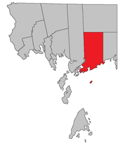 Location within Charlotte County. | |
| Country | |
| Province | |
| County | Charlotte County |
| Established | 1786 |
| Area | |
| • Land | 363.86 km2 (140.49 sq mi) |
| Population (2016)[1] | |
| • Total | 2,170 |
| • Density | 6.0/km2 (16/sq mi) |
| • Pop 2011-2016 | |
| • Dwellings | 996 |
| Time zone | UTC-4 (AST) |
| • Summer (DST) | UTC-3 (ADT) |
The Census subdivision of the same name includes all of the parish except the village of Blacks Harbour.[1]
History
Pennfield Parish was established in 1786: named by Pennsylvania Quakers for William Penn (1644-1718), English Quaker leader and founder of Pennsylvania: Pennfield Parish included Lepreau Parish until 1857.
Delineation
Pennfield Parish is defined in the Territorial Division Act[2] as being bounded:
- Westerly by Saint George Parish and Letang River; north by Clarendon Parish; east by a line commencing at the western bank or shore of the Pocologan River, where it falls into the Bay of Fundy, and running true north to Clarendon Parish; and south by the Bay of Fundy, including The Wolves Islands, and all other islands within two miles of the shore and not included in Saint George Parish.
Communities
Parish population total does not include incorporated municipalities (in bold):
|
|
Bodies of water and islands
This is a list of rivers, lakes, streams, creeks, marshes and Islands that are at least partially in this parish
|
|
Demographics
Population
| Canada census – Pennfield Parish, New Brunswick community profile | |||
|---|---|---|---|
| 2016 | 2011 | 2006 | |
| Population: | 2,170 (-2.2% from 2011) | 2,218 (-4.5% from 2006) | 2,322 (-3.9% from 2001) |
| Land area: | 363.86 km2 (140.49 sq mi) | 363.88 km2 (140.49 sq mi) | 363.88 km2 (140.49 sq mi) |
| Population density: | 6.0/km2 (16/sq mi) | 6.1/km2 (16/sq mi) | 6.4/km2 (17/sq mi) |
| Median age: | 46.7 (M: 46.5, F: 47.0) | 44.3 (M: 44.1, F: 44.4) | 41.8 (M: 42.2, F: 41.4) |
| Total private dwellings: | 996 | 1,099 | 1,120 |
| Median household income: | $60,992 | $58,972 | $42,996 |
| References: 2016[3] 2011[4] 2006[5] earlier[6] | |||
|
|
| |||||||||||||||||||||||||||
| [7][8][1] | |||||||||||||||||||||||||||||
Language
| Canada Census Mother Tongue - Pennfield Parish, New Brunswick[7] | ||||||||||||||||||
|---|---|---|---|---|---|---|---|---|---|---|---|---|---|---|---|---|---|---|
| Census | Total | English |
French |
English & French |
Other | |||||||||||||
| Year | Responses | Count | Trend | Pop % | Count | Trend | Pop % | Count | Trend | Pop % | Count | Trend | Pop % | |||||
2011 |
2,195 |
2,045 | 93.17% | 90 | 4.10% | 5 | 0.23% | 55 | 2.50% | |||||||||
2006 |
2,305 |
2,205 | 95.66% | 55 | 2.39% | 0 | 0.00% | 45 | 1.95% | |||||||||
2001 |
2,410 |
2,265 | 93.98% | 115 | 4.77% | 10 | 0.42% | 20 | 0.83% | |||||||||
1996 |
2,240 |
2,145 | n/a | 95.76% | 70 | n/a | 3.12% | 0 | n/a | 0.00% | 25 | n/a | 1.12% | |||||
Access Routes
Highways and numbered routes that run through the parish, including external routes that start or finish at the parish limits:[9]
|
|
|
|
See also
Notes
References
- "Census Profile, 2016 Census: Pennfield, Parish [Census subdivision], New Brunswick". Statistics Canada. Retrieved 7 September 2019.
- "Chapter T-3 Territorial Division Act". Government of New Brunswick. Retrieved 14 August 2020.
- "2016 Community Profiles". 2016 Canadian Census. Statistics Canada. 21 February 2017. Retrieved 7 September 2019.
- "2011 Community Profiles". 2011 Canadian Census. Statistics Canada. 5 July 2013. Retrieved 15 March 2014.
- "2006 Community Profiles". 2006 Canadian Census. Statistics Canada. 30 March 2011. Retrieved 15 March 2014.
- "2001 Community Profiles". 2001 Canadian Census. Statistics Canada. 17 February 2012.
- Statistics Canada: 1996, 2001, 2006, 2011 census
- 2011 Statistics Canada Census Profile: Pennfield Parish, New Brunswick
- Atlantic Canada Back Road Atlas ISBN 978-1-55368-618-7 Pages 4, 12
Places adjacent to Pennfield Parish, New Brunswick | |
|---|---|
| Subdivisions |
|
|---|---|
| Cities | |
| Counties | |
| |