California Historical Landmarks in San Francisco
List table of the properties and districts — listed on the California Historical Landmarks — within City and County of San Francisco, California.
- Note: Click the "Map of all coordinates" link to the right to view a Google map of all properties and districts with latitude and longitude coordinates in the table below.
Listings
width = 8% class="unsortable" style="background-color:
|
style="background-color:
|
width = 18% style="background-color:
|
style="background-color:
|
Neighborhood/Region | style="background-color:
|
|---|---|---|---|---|---|
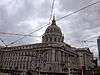
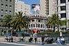
 Birthplace of the United Nations, War Memorial Complex |
style="background-color:
|
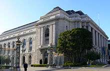
Birthplace of the United Nations, War Memorial Complex | San Francisco War Memorial and Performing Arts Center |
Civic Center | |
 California Masonic Lodge No. 1 |
style="background-color:
|
California Masonic Lodge No. 1 | 728 Montgomery St. |
Jackson Square | |
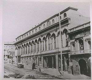 California Theatre |
style="background-color:
|
California Theatre | 430 Bush St |
Financial District | |
 Castillo De San Joaquín |
style="background-color:
|
Castillo De San Joaquín | 37°48′38″N 122°28′36″W |
Presidio | |
.JPG) City of Paris building |
style="background-color:
|
City of Paris building | SE corner of Geary and Stockton Sts. |
Union Square | |
style="background-color:
|
Eastern Terminus of Clay Street Hill Railroad | Portsmouth Square |
Chinatown | ||
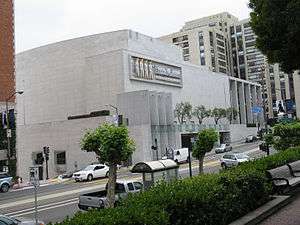
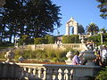
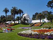 Conservatory of Flowers |
style="background-color:
|
Conservatory of Flowers | Golden Gate Park 37°46′19″N 122°27′36″W |
Golden Gate Park | |
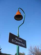 El Camino Real |
style="background-color:
|
El Camino Real | Mission District | The same plaque is located in San Diego | |
 Site of the Jenny Lind Theatre and San Francisco City Hall |
style="background-color:
|
Site of the Jenny Lind Theatre and San Francisco City Hall | 750 Kearny St at Merchant |
Portsmouth Square | |
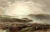
 Entrance of the San Carlos into San Francisco Bay |
style="background-color:
|
Entrance of the San Carlos into San Francisco Bay | Aquatic Park, NW corner of Beach and Larkin Sts |
Fisherman's Wharf | |
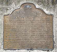 Farnsworth's Green Street Lab |
style="background-color:
|
Farnsworth's Green Street Lab | NW corner of Sansome and Green Sts. 37°48′01″N 122°24′11″W |
North Beach | |
style="background-color:
|
First dynamite factory in the United States | Glen Canyon Park 37°44′20″N 122°26′31″W |
Diamond Heights/Glen Park | The location of a subsequent Giant Powder Company factory in Point Pinole is listed as California Historical Landmark number 1002-1. | |
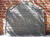
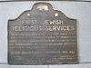 First Jewish religious services in San Francisco |
style="background-color:
|
First Jewish religious services in San Francisco | 735 Montgomery between Washington and Jackson 37°47′46″N 122°24′13″W |
Jackson Square | |
.jpg) First Public School in California |
style="background-color:
|
First Public School in California | Portsmouth Plaza 37°47′41″N 122°24′20″W |
Chinatown | |
.jpg) First San Francisco Mint building |
style="background-color:
|
First San Francisco Mint building | 608-610 Commercial St. 37°47′39″N 122°24′12″W |
Financial District | |
 Fort Gunnybags |
style="background-color:
|
Fort Gunnybags | S side of Sacramento between Davis and Front |
Financial District | |
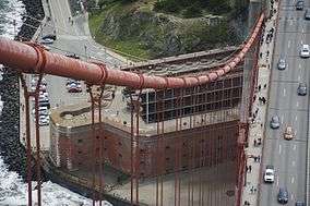
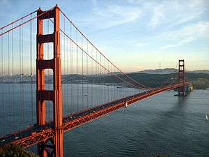 Golden Gate Bridge |
style="background-color:
|
Golden Gate Bridge | 37°49′11″N 122°28′43″W |
Presidio | |
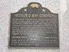 Hudson's Bay Company headquarters |
style="background-color:
|
Hudson's Bay Company headquarters | 505 Montgomery 37°47′39″N 122°24′12″W |
Financial District | |
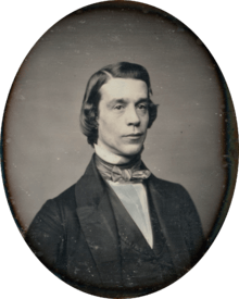
 Juana Briones, Pioneer settler of Yerba Buena |
style="background-color:
|
Juana Briones, Pioneer settler of Yerba Buena | Washington Square |
North Beach | |
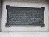 Landing place of Captain J. Montgomery |
style="background-color:
|
Landing place of Captain J. Montgomery | 552 Montgomery St. 37°47′41″N 122°24′19″W |
Financial District | |
 Laurel Hill Cemetery |
style="background-color:
|
Laurel Hill Cemetery | 3333 California St. |
Laurel Heights | |
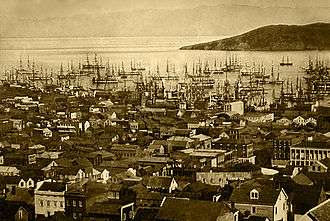 Long Wharf |
style="background-color:
|
Long Wharf | Leidesdorff and Commercial Sts. |
Financial District | |
 Lucas, Turner & Co. Bank |
style="background-color:
|
Lucas, Turner & Co. Bank | NE corner of Montgomery and Jackson |
Jackson Square | |
 Mark Hopkins Institute of Art |
style="background-color:
|
Mark Hopkins Institute of Art | California at Mason |
Nob Hill | |
.jpg) Liberty Bell Slot Machine |
style="background-color:
|
Liberty Bell Slot Machine | Traffic island on N side of Market St between Bush and Battery Sts. 37°47′28″N 122°23′58″W |
Financial District | |
style="background-color:
|
Mellus and Howard | 555 Montgomery |
Financial District | ||
Montgomery Block |
style="background-color:
|
Montgomery Block | 600 Montgomery St. 37°47′42″N 122°24′11″W |
Financial District | |
.jpg) Niantic Hotel |
style="background-color:
|
Niantic Hotel | First floor of Two Transamerica Center 37°47′42″N 122°24′08″W |
Financial District | |
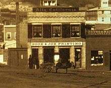 Office of the California Star newspaper |
style="background-color:
|
Office of the California Star newspaper | 743 Washington St |
Chinatown | |
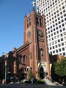 Old Saint Mary's Cathedral |
style="background-color:
|
Old Saint Mary's Cathedral | 660 California St. 37°47′34″N 122°24′21″W |
Nob Hill | |
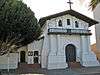 Original Mission Dolores and Dolores Lagoon |
style="background-color:
|
Original Mission Dolores and Dolores Lagoon | Camp and Albion Sts. 37°45′51″N 122°25′22″W |
Mission District | |
style="background-color:
|
Original site of the Bancroft Library | 1538 Valencia St. |
Mission District | ||
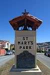 Original site of St. Mary's College |
style="background-color:
|
Original site of St. Mary's College | Mission and College Sts. |
Bernal Heights | |
style="background-color:
|
Original site of the Third Baptist Church | Grant Ave and Greenwich 37°48′09″N 122°24′28″W |
Telegraph Hill | ||
style="background-color:
|
Parrott Granite Block | California and Montgomery |
Financial District | ||
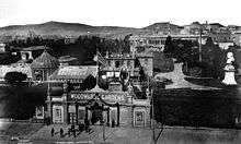
Portsmouth Plaza |
style="background-color:
|
Portsmouth Plaza | Portsmouth Square |
Chinatown | |
 Presidio of San Francisco |
style="background-color:
|
Presidio of San Francisco | Funston Ave. and Lincoln Blvd. 37°47′53″N 122°27′57″W |
Presidio | |
.jpg) Rincon Hill |
style="background-color:
|
Rincon Hill | Rincon and Bryant Sts. |
Rincon Hill | |
San Francisco Mint |
style="background-color:
|
San Francisco Mint | Plaque in sidewalk, NE corner of Bush and Market Sts. 37°46′58″N 122°24′21″W |
Lower Nob Hill | |
 Sarcophagus of Thomas Starr King |
style="background-color:
|
Sarcophagus of Thomas Starr King | First Unitarian Church of San Francisco |
Western Addition | |
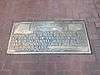 Shoreline markers |
style="background-color:
|
Shoreline markers | Plaque in sidewalk, NE corner of Bush and Market Sts. 37°47′29″N 122°23′57″W |
Financial District | |
.jpg) Site of the first California State fair |
style="background-color:
|
Site of the first California State fair | 269 Bush 37°47′27″N 122°24′05″W |
Financial District | |
 Telegraph Hill |
style="background-color:
|
Telegraph Hill | 37°48′09″N 122°24′21″W |
Telegraph Hill | |
Treasure Island |
style="background-color:
|
Treasure Island | 37°49′N 122°22′W |
Treasure Island | |
 Union Square |
style="background-color:
|
Union Square | Geary and Powell 37°47′17″N 122°24′27″W |
Union Square | |
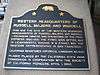 Western business headquarters of Russell, Majors and Waddell (Pony Express) |
style="background-color:
|
Western business headquarters of Russell, Majors and Waddell (Pony Express) | 601 Montgomery St. 37°47′42″N 122°24′12″W |
Financial District | |
.jpg) What Cheer House |
style="background-color:
|
What Cheer House | SW corner of Sacramento and Leidesdorff Sts. 37°47′38″N 122°24′08″W |
Financial District | |
 Woodward's Gardens |
style="background-color:
|
Woodward's Gardens | SW corner of Mission and Duboce Sts. |
Mission District |
gollark: Clearly we need to merge the brightness and volume ones into one with *full N-body gravity*.
gollark: Shame the orbital mechanics simulation seems to work a bit weirdly.
gollark: Now with 50% more peers!
gollark: If you're *uploading* videos, I mean, you could use that. YouTube... has most of the interesting video content...
gollark: Almost 100%!
See also
| Wikimedia Commons has media related to California Historical Landmarks in San Francisco. |
References
- "California Historical Landmarks By County". Ohp.parks.ca.gov. Retrieved 2019-04-03.
This article is issued from Wikipedia. The text is licensed under Creative Commons - Attribution - Sharealike. Additional terms may apply for the media files.