Año Nuevo State Marine Conservation Area
Año Nuevo State Marine Conservation Area (SMCA) is one of two adjoining marine protected areas off the coast of San Mateo and Santa Cruz Counties, on California’s central coast. The area is approximately 55 miles south of San Francisco. The SMCA is 11.07 square miles. Except for limited taking of giant kelp, all living marine resources are protected.[1]

History
The Año Nuevo SMCA was established in September 2007 by the California Department of Fish and Game. It was one of 29 marine protected areas adopted during the first phase of the Marine Life Protection Act Initiative. The Marine Life Protection Act Initiative (or MLPAI) is a collaborative public process to create a statewide network of marine protected areas along the California coastline.
The SMCA was designed to protect marine life while keeping nearby favored recreational fishing grounds open to fishing. Important fishing grounds to the north of Point Año Nuevo and from Moss Landing to Davenport remain open to fishing.
Geography and natural features
Año Nuevo SMCA is adjacent to Ano Nuevo State Park, and includes the waters surrounding Point Ano Nuevo and Ano Nuevo Island. Greyhound Rock State Marine Conservation Area adjoins the site to the south.
This marine protected area is bounded by the mean high tide line and a distance of 200 feet seaward of mean lower low water between the following two points:[2]
The area then continues southward bounded by the mean high tide line and straight lines connecting the following points in the order listed:
Habitat and wildlife
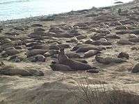
Point Año Nuevo is used by thousands of breeding seabirds and marine mammals and supports a world famous elephant seal haul out and breeding ground. The waters surrounding the point attract a concentration of great white sharks and include documented “hotspots” for depleted canary rockfish. Threatened marbled murrelets rest on shore and forage in the lee of the point.
Ano Nuevo SMCA provides habitat for a variety of marine life, and includes rocky intertidal, sandy beach, estuary, offshore rocks and islands, shale reef, bull kelp and giant kelp forest.[3]
Recreation and nearby attractions
The adjacent State Parks have extensive docent programs (including docent lead tours to the elephant seal colony during the months of December through March in Ano Nuevo State Reserve), outreach and interpretive facilities, parking, and an on-site ranger presence to assist with management and enforcement.
California’s marine protected areas encourage recreational and educational uses of the ocean.[4] Activities such as kayaking, diving, snorkeling, and swimming are allowed unless otherwise restricted.
Scientific monitoring
As specified by the Marine Life Protection Act, select marine protected areas along California’s central coast are being monitored by scientists to track their effectiveness and learn more about ocean health. Similar studies in marine protected areas located off of the Santa Barbara Channel Islands have already detected gradual improvements in fish size and number.[5]
References
- California Department of Fish and Game. "Online Guide to California’s Central Coast Marine Protected Areas". Retrieved on December 18, 2008
- California Department of Fish and Game. "Central Coast Marine Protected Areas". Retrieved December 18, 2008.
- Department of Fish and Game. "Appendix O. Regional MPA Management Plans". Master Plan for Marine Protected Areas (approved February 2008). Retrieved December 18, 2008.
- Department of Fish and Game. "California Fish and Game Code section 2853 (b)(3)". Marine Life Protection Act. Retrieved December 18, 2008.
- Castell, Jenn, et al. "How do patterns of abundance and size structure differ between fished and unfished waters in the Channel Islands? Results from SCUBA surveys Archived May 31, 2010, at the Wayback Machine". Partnership for Interdisciplinary Studies of Coastal Oceans (PISCO) at University of California, Santa Barbara and University of California, Santa Cruz; Channel Islands National Park. Retrieved December 18, 2008.