Caledonia Township, Illinois
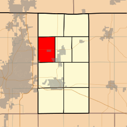
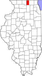
Caledonia Township is one of nine townships in Boone County, Illinois, United States. As of the 2010 census, its population was 7,439 and it contained 2,537 housing units.[2] Sometime after 1921, Poplar Grove Township was formed from a portion of Caledonia Township.
Caledonia Township | |
|---|---|
 Location in Boone County | |
 Boone County's location in Illinois | |
| Coordinates: 42°22′15″N 88°54′06″W | |
| Country | United States |
| State | Illinois |
| County | Boone |
| Settlement | November 6, 1849 |
| Area | |
| • Total | 24.35 sq mi (63.1 km2) |
| • Land | 24.04 sq mi (62.3 km2) |
| • Water | 0.31 sq mi (0.8 km2) 1.27% |
| Elevation | 912 ft (278 m) |
| Population (2010) | |
| • Estimate (2016)[1] | 7,397 |
| • Density | 309.5/sq mi (119.5/km2) |
| Time zone | UTC-6 (CST) |
| • Summer (DST) | UTC-5 (CDT) |
| ZIP codes | 61008, 61011, 61065 |
| FIPS code | 17-007-10435 |
Geography
According to the 2010 census, the township has a total area of 24.35 square miles (63.1 km2), of which 24.04 square miles (62.3 km2) (or 98.73%) is land and 0.31 square miles (0.80 km2) (or 1.27%) is water.[2]
Cities
- Caledonia
- Loves Park (west edge)
- Poplar Grove (east edge)
- Timberlane (northwest three-quarters)
Extinct towns
- North Caledonia
Cemeteries
The township contains Drake Cemetery.
Major highways

School districts
- Belvidere Consolidated Unit School District 100
- North Boone Community Unit School District 200
- Rockford School District 205
Political districts
- Illinois' 16th congressional district
- State House District 69
- State Senate District 35
gollark: We determined that you are to, however.
gollark: <@319753218592866315> Make 127414 macrons/second.
gollark: Oh, that explains a lot.
gollark: > Heavpoot was working on it.<|endoftext|>I think so.<|endoftext|>I think the best way to do this is to have people *add* everyone's computers somewhere.<|endoftext|>Maybe the computers are just done in software.<|endoftext|>Idea: copy a device which can remotely update things, and have them *too* easily.<|endoftext|>I think the practice of having computers themselves is that a sane device is very slow and has all computers run terminals and whatnot can't do those.<|endoftext|>Or at least a screen window manager or something.<|endoftext|>Idea: a CC-like system where the screen can be icons, or an entity sensor it.<|endoftext|>The screen can't automatically display the icons properly, but the screen is a bit weird.<|endoftext|>I think OLED would make it draw terminals okay.<|endoftext|>At least, it's not OLED.<|endoftext|>Well, OLED doesn't make it good.<|endoftext|>If they make it OLED or something it may not work.<|endoftextIt does NOT like OLED!
gollark: mgollark owns the copyright to that idea actually.
References
- "Caledonia Township, Boone County, Illinois". Geographic Names Information System. United States Geological Survey. Retrieved 2010-01-04.
- United States Census Bureau 2007 TIGER/Line Shapefiles
- United States National Atlas
- "Population and Housing Unit Estimates". Retrieved June 9, 2017.
- "Population, Housing Units, Area, and Density: 2010 - County -- County Subdivision and Place -- 2010 Census Summary File 1". United States Census Bureau. Archived from the original on 2020-02-12. Retrieved 2013-05-28.
- "Census of Population and Housing". Census.gov. Retrieved June 4, 2016.
This article is issued from Wikipedia. The text is licensed under Creative Commons - Attribution - Sharealike. Additional terms may apply for the media files.