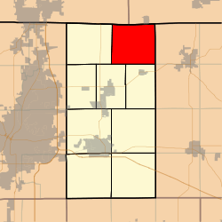
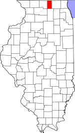
Leroy Township, Boone County, Illinois
LeRoy Township is one of nine townships in Boone County, Illinois, USA. As of the 2010 census, its population was 485 and it contained 207 housing units.[1]
LeRoy Township | |
|---|---|
 Location in Boone County | |
 Boone County's location in Illinois | |
| Coordinates: 42°27′30″N 88°45′53″W | |
| Country | United States |
| State | Illinois |
| County | Boone |
| Settlement | November 6, 1849 |
| Area | |
| • Total | 31.28 sq mi (81.0 km2) |
| • Land | 31.27 sq mi (81.0 km2) |
| • Water | 0.01 sq mi (0.03 km2) 0.03% |
| Elevation | 942 ft (287 m) |
| Population (2010) | |
| • Total | 485 |
| • Density | 15.5/sq mi (6.0/km2) |
| Time zone | UTC-6 (CST) |
| • Summer (DST) | UTC-5 (CDT) |
| ZIP codes | 60033, 61012, 61065 |
| GNIS feature ID | 0429247 |
Geography
According to the 2010 census, the township has a total area of 31.28 square miles (81.0 km2), of which 31.27 square miles (81.0 km2) (or 99.97%) is land and 0.01 square miles (0.026 km2) (or 0.03%) is water.[1]
Unincorporated towns
Cemeteries
The township contains these five cemeteries: Blaine, Burr Oak, Dullam, Stone School and Round Prairie.
Airports and landing strips
- Munch Heliport
- Pine Hill Airport
Demographics
School districts
- Harvard Community Unit School District 50
- North Boone Community Unit School District 200
Political districts
- Illinois' 16th congressional district
- State House District 69
- State Senate District 35
gollark: Python has an annoying limitation where times above 9999 years are artificially blocked.
gollark: CBOR somehow became the trendy thing despite mostly being worse.
gollark: I just do any conveniently timed competition.
gollark: So don't unless it has positive effects generally!
gollark: The tournament arc is 2023.
References
- "Leroy Township, Boone County, Illinois". Geographic Names Information System. United States Geological Survey. Retrieved 2010-01-04.
- United States Census Bureau 2007 TIGER/Line Shapefiles
- United States National Atlas
- "Population, Housing Units, Area, and Density: 2010 - County -- County Subdivision and Place -- 2010 Census Summary File 1". United States Census. Archived from the original on 2020-02-12. Retrieved 2013-05-28.
External links
This article is issued from Wikipedia. The text is licensed under Creative Commons - Attribution - Sharealike. Additional terms may apply for the media files.