Caimito, Cuba
Caimito is a municipality and town in Artemisa Province of Cuba. The town was founded in 1820. The municipality of Caimito del Guayabal was created in 1910, based on the previously existing (1879-1902) municipality of Guayabal in the Pinar del Río Province.[1] Since 1976, the official name is Caimito.
Caimito | |
|---|---|
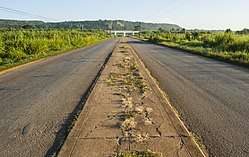 The road to Guayabal outside Caimito | |
.png) Caimito municipality (red) within Artemisa Province (yellow) and Cuba | |
| Coordinates: 22°57′27″N 82°35′47″W | |
| Country | Cuba |
| Province | Artemisa |
| Founded | 1910[1] |
| Area | |
| • Total | 238 km2 (92 sq mi) |
| Elevation | 95 m (312 ft) |
| Population (2004)[3] | |
| • Total | 36,813 |
| • Density | 154.7/km2 (401/sq mi) |
| Time zone | UTC-5 (EST) |
| Area code(s) | +53-7 |
| Climate | Am |
Geography
The municipality is divided into the villages of Caimito, Guayabal, Ceiba del Agua, Pluebo Nuevo, Rancho Grande, Capellanías, Vereda Nueva, Los Naranjos, Aguacate, Banes, Habana Libre and Menelao Mora.[1]
Demographics
In 2004, the municipality of Caimito had a population of 36,813.[3] With a total area of 238 km2 (92 sq mi),[2] it has a population density of 154.7/km2 (401/sq mi).
Transport
Caimito, crossed by the Carretera Central, is served by A4 motorway, passing some km north. From 2014, it counts a railway station on the new Havana-Guanajay-Artemisa/Mariel line, part of the Havana-Artemisa-Pinar del Río line. Playa Baracoa Airport, serving Havana, is located in the municipal territory, and lies in front of Playa Baracoa, a village belonging to the neighboring municipality of Bauta.[4][5][6]
References
- Guije.com. "Caimito" (in Spanish). Retrieved 2007-10-08.
- Statoids (July 2003). "Municipios of Cuba". Retrieved 2007-10-08.
- Atenas.cu (2004). "2004 Population trends, by Province and Municipality" (in Spanish). Archived from the original on 2006-07-14. Retrieved 2007-10-08.
- 455624731 Playa Baracoa on OpenStreetMap
- 259849770 Playa Baracoa Airport on OpenStreetMap
- (in Spanish) Playa Baracoa on EcuRed