Autopista A4 (Cuba)
The Autopista A4, also known as Autopista Este-Oeste or Autopista Nacional Este-Oeste, is a Cuban motorway linking Havana to Pinar del Río.[1] It is a toll-free road and has a length of 156 km (97 mi). Along with the Autopista A1 (Autopista Nacional), partly built, that will link Havana to Guantánamo, it is classified as part of the whole Autopista Nacional route,[2] spanning the length of the island; as the Carretera Central highway.
| |
|---|---|
| Autopista Este-Oeste | |
| East-West Motorway | |
.png) Map of the Cuban motorway network | |
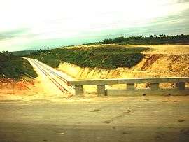
 The A4 at the exit of Candelaria | |
| Route information | |
| Length | 156 km (97 mi) |
| Existed | 1989–present |
| Major junctions | |
| East end | Havana |
| West end | Pinar del Río |
| Location | |
| Major cities | Havana, Guanajay, Artemisa, San Cristóbal, Consolación del Sur, Pinar del Río |
| Highway system | |
| Roads in Cuba | |

History
The motorway, connected to the A1 via the Havana Beltway (A2), was opened on December 19, 1989.[2]
Route
The A4 is a dual carriageway with 6 lanes from Havana to Guanajay, 4 lanes from Guanajay to Pinar del Río, and has some at-grade intersections with rural roads. From Guanajay it is a beltway (Autopista ZEDM) linking the A4 to the Port of Mariel.
| AUTOPISTA A4 (Autopista Este-Oeste) | |||||
| Exit | ↓km↓ | Province | Note | ||
|---|---|---|---|---|---|
| 0.0 | Havana | ||||
(link to | 1.7 | Havana | |||
| 4.9 | Havana | ||||
(to San Antonio de los Baños) | 8.4 | Havana | |||
| 16.7 | Artemisa | ||||
| 24.7 | Artemisa | ||||
( | 37.0 | Artemisa | |||
| 41.0 | Artemisa | ||||
| 54.3 | Artemisa | ||||
| 60.4 | Artemisa | ||||
| 71.6 | Artemisa | ||||
(to Bahía Honda) | 82.4 | Artemisa | |||
| 90.0 | Artemisa | ||||
| 95.5 | Artemisa | ||||
| 105.0 | Pinar del Río | ||||
| 112.0 | Pinar del Río | ||||
| 125.0 | Pinar del Río | ||||
| 134.0 | Pinar del Río | ||||
| 141.0 | Pinar del Río | ||||
| 146.0 | Pinar del Río | ||||
| 153.0 | Pinar del Río | ||||
| 156.0 | Pinar del Río | ||||
| A4 – Port of Mariel Beltway (Autopista ZEDM) | |||||
| Exit | ↓km↓ | Province | Note | ||
| 0.0 | Artemisa | ||||
| 1.5 | Artemisa | ||||
| 4.1 | Artemisa | ||||
| 10.0 | Artemisa | ||||
References
- Source: Mapa de Carreteras de Cuba (Road map of Cuba). Ediciones GEO, Havana 2011 - ISBN 959-7049-21-X
- (in Spanish) Autopista Nacional on EcuRed
External links
![]()